Henry G. Shirley Memorial Highway |
The Henry G. Shirley Memorial Highway is the 17.3 miles of I-95 and I-395, from near Woodbridge, Virginia, to the south end of the 14th Street Bridge which carries I-395 into the District of Columbia.
Article index with internal links
Introduction
Henry G. Shirley - Commissioner of Virginia Department
of Highways
Shirley Highway Early History
Pentagon Road System
Summary of Original Shirley Highway Openings
Shirley Highway in the 1950s - Early Years of Completed Highway
Shirley Highway in the 1960s - Planning and Beginning the
Reconstruction
Transfer of Pentagon Road System From Federal
Government to Virginia
Shirley Highway Today
Sources
Links to External Websites
Links to My Website Articles
Acronyms
Credits
Virginia's first limited access freeway, the Henry G. Shirley Memorial Highway, was completed from Woodbridge, Virginia to the 14th Street Bridge over the Potomac River, in 1952, and it was 17.3 miles long. The road was a four-lane freeway, and it was designated Virginia Route 350 from US-1 at its south end to US-1 near the Pentagon Building, and the highway was designated US-1 on its northernmost 0.7 mile; and the 14th Street Bridge was also designated US-1. Shirley Highway was named after the Virginia Department of Highways commissioner (agency head) who died in July, 1941, just a few weeks after giving the "go ahead" for work on the new freeway. The section in Arlington was opened in 1944, at the time the Pentagon (War Department Building) was completed. This section included the Mixing Bowl interchange complex near the Pentagon with VA-27 and the Pentagon parking lots. Shirley Highway was designated as Interstate 95 as projects were completed as it was reconstructed to Interstate standards from 1965 to 1975, with the 13 miles from US-1 near Woodbridge to VA-7 King Street being completed by 1968, and the remainder from VA-7 to the 14th Street Bridge being completed by 1975.
Interstate 395 in Virginia runs for 9.6 miles, from the I-95/I-495 Capital Beltway at Springfield to the 14th Street Bridge Complex (I-395 and US-1) over the Potomac River. This highway was originally I-95, and it was redesignated I-395 in 1977 because of the rerouting of I-95 to the eastern half of the Capital Beltway, done because of the cancellation of proposed I-95 from New York Avenue in the District of Columbia, northward into Prince George's County to the I-495 Capital Beltway. I-395 continues in D.C. up to New York Avenue.
The southern end of the original Shirley Highway had a high-speed wye interchange with US-1 about 0.8 mile north of the Occoquan River, which is just north of Woodbridge. I-95 was completed from Fredericksburg to the south end of Shirley Highway in 1964, with I-95 joining Shirley Highway at what is today's Exit 161. Actually, a section of the original beginning of the 2-lane northbound Shirley Highway roadway, about 1/3-mile-long, unwidened and nearly in its original state with the concrete pavement overlaid with asphalt, still exists as the northbound onramp from US-1 northbound to I-95 northbound.
Shirley Highway was reconstructed to urban interstate standards from 1965 to 1975, at a cost of $162 million. The number of lanes ranged from six lanes near Woodbridge to twelve lanes at the 14th Street Bridge, with a maximum of 18 lanes in the Mixing Bowl. During the reconstruction, in 1969, a reversible exclusive busway was opened, allowing express bus traffic in the rush-hour direction of traffic. This was the first such facility on a freeway in the nation. As mentioned before, I-95 inside the Beltway was redesignated I-395 in 1977. The reversible 2-lane HOV roadway runs from just south of the VA-644 interchange at Springfield to near the Pentagon where it divides into a northbound and southbound pair of 2-lane express roadways between there and the Southeast Freeway and 14th Street in the District of Columbia. The 2-lane reversible HOV roadway runs the whole length of Shirley Highway today, with I-95 widening projects having extended the HOV roadway from Springfield to Dumfries, completed in sections in a southward sequence from November 1994 to June 1997.
The Mixing Bowl Interchange Complex near the Pentagon was rebuilt from 1970 to 1973, as part of the reconstruction of Shirley Highway. The original Shirley Highway was a four-lane freeway. The Mixing Bowl interchange is where the VA-27 freeway (Washington Blvd.) merges with Shirley Highway and then branches off again. The original interchange had a merge section each way, about 1/3 mile long, with a third "mixing lane" where the vehicles would weave when they wanted to change to the other freeway. By the late 1960s, it was a severe bottleneck during rush hour. The rebuilt interchange has the same conceptual movements, but the weaves take place on grade-separated semi-directional ramps. It is a massive interchange. One cross-section point has 27 lanes on three levels and 10 separate roadways. Eliminating non-freeway parts of the cross-section, the facility is 18 lanes wide. The Mixing Bowl includes not just the weave section between I-395 and VA-27, but also interchanges with the Pentagon parking lots (which are huge) and Pentagon City, and with VA-244 Columbia Pike. Not directly related to the highway, but in the Mixing Bowl project, the WMATA Metrorail subway tunnel was built under Shirley Highway, for the Huntington Route (Blue Line and Yellow Line trains) near where Hayes Street junctions with Army-Navy Drive. That segment of Metrorail opened to passenger service in July 1977.
According to an Engineering News-Record feature article in 1973, the rebuilt Mixing Bowl comprised the largest interchange complex in the world. A 2-1/2 mile section of Shirley Highway has 52 lane-miles of roadways and ramps, with four freeway junctions and numerous local ramps, and with several interchanges to the reversible express (HOV) roadway on Shirley Highway. I don't think that there are any larger interchange complexes built since then. [30]
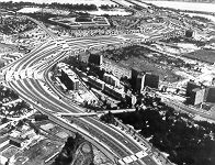
See my article
Mixing Bowl Interchange Complex for aerial photos
of the Mixing Bowl. VDOT photo rendering above.
See "The Mixing Bowl Project (1970-1973)", and "The Pentagon Building (1941-1943)", from The History and Heritage of Civil Engineering in Virginia, by J.C. Hanes and J.M. Morgan, Jr., 1973, Virginia Section of American Society of Civil Engineers.
See my article Shirley Highway Busway/HOV System for a detailed Virginia Highway Bulletin July 1974 article about the busway/HOV system and the highway reconstruction.
"Springfield Interchange" - Not "Mixing Bowl"
The current Springfield Interchange Project involves reconstructing what is actually two interchanges: 1) The interchange between Shirley Highway and the Capital Beltway. Shirley Highway is I-95 south of the Beltway, and is I-395 north of the Beltway. The Capital Beltway is I-495 throughout, and carries I-95 also east of Shirley Highway. 2) The interchange between I-95 Shirley Highway and VA-644. VA-644 is Franconia Road east of I-95 and is Old Keene Mill Road west of I-95.
The current 8-year, 7-phase Springfield Interchange construction project began in March 1999 and is on schedule for completion in 2007. On this project, the Virginia Department of Transportation (VDOT) is the administrator of the planning, design, right-of-way acquisition and construction. Throughout their literature, they use the name "Springfield Interchange Project" or "Springfield Interchange Improvement Project" to denote the name of this project. The name "Mixing Bowl" has been widely used recently in the local media for this interchange and project. VDOT only very occasionally uses that name, and for good reason -- the Mixing Bowl is the historic name for the interchange between I-395 Shirley Highway and VA-27 Washington Boulevard in Arlington, Virginia, near the Pentagon. The Mixing Bowl interchange is where the VA-27 freeway (Washington Blvd.) merges with I-395 and then branches off again. For more details, see my aforementioned website article "Mixing Bowl Interchange Complex", and the aforementioned Virginia Section of American Society of Civil Engineers article "The Mixing Bowl Project (1970-1973)", from The History and Heritage of Civil Engineering in Virginia, by J.C. Hanes and J.M. Morgan, Jr., 1973. The "Mixing Bowl" name was applied to this interchange as far back as 1943 when it was originally opened, and I find it absurd that just in the last few years the local media has started calling another interchange just 8 miles away by the same name! Having two interchanges so close to each other, with each having the same name, is illogical and nonsensical. The Mixing Bowl name has never been removed from the I-395/VA-27 interchange, as far as I know. Henceforth, I refuse to use that name for the I-95/I-395/I-495 interchange -- I will call it the "Springfield Interchange" throughout this article and anywhere else it is mentioned on this website.
Henry G. Shirley - Commissioner of Virginia Department
of Highways
Henry Garnett Shirley was the Commissioner
(agency head) of the Virginia Department of Highways (VDH), from 1922 until his
death in July 1941. His 19-year tenure is the longest of any of the 14 Commissioners
in the history of VDH/VDOT which began in 1906. He served under five different
governors and is credited with leading the Department of Highways through many
of its critical early years when the state primary highway system was being built
as modern paved motor vehicle roads, and when much of the state secondary highway
system was being modernized to carry motor vehicles and to “get the farmers out
of the mud” (the old unimproved secondary roads often turned to mud after a heavy
rain).
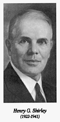
Photo from A History of Roads
in Virginia "The Most Convenient Wayes", 2002, page 46, Virginia's
Highway Commissioners, Virginia Department of Transportation. Here is a
cite of what one of his contemporaries (the division administrator of the
Location and Design Division of the Virginia Department of Highways) wrote
about him in 1946 (blue text):
The Henry G. Shirley Memorial Highway will be Virginia’s
first example of a modern Express Highway with controlled access, and was
named by Act of the Commission in March, 1942, for the late beloved Henry
G. Shirley, first President of the American Association of State Highway Officials,
and Highway Commissioner of Virginia from 1922 until his death in July 1941.
[2] Another cite from the Virginia Road Builder, “The Shirley Memorial Highway”, July-August 1950, (blue text): The expressway is named in memory of the late Henry G. Shirley, who died in 1941 after serving for 19 years as Virginia’s Highway Commissioner. During these 19 years, Virginia raised the standards for her roads, building them on a “pay-as-you-go” basis until she became the envy of her sister states. Only a few weeks before his death, Mr. Shirley gave the “go ahead” for work on this expressway, in order to prepare Virginia for the threatened war. [8] |
A History of the Commonwealth
Transportation Board, by the Virginia Department of Transportation (VDOT),
1986, has this biography of Henry G. Shirley (blue text):
Henry G. Shirley (1922-1941)
Henry G. Shirley was first appointed
by Governor E. Lee Trinkle and also served under Governors Harry F. Byrd, John
Garland Pollard, George C. Peery and James H. Price. He saw the need for an advanced
highway plan leading through the Virginia suburbs to Washington, D.C., and under
his direction, work began on the first limited access road in the state. Now known
as the Henry G. Shirley Memorial Highway, the road, which is part of I-95 and
I-395, extends from Route 1 in Northern Virginia to the 14th Street Bridge in
Washington, D.C. Shirley held a position as professor of military science at Horner
Military School in Oxford, N.C. After serving in the Spanish-American War, he
worked for the New York Central and Hudson River Railroad and other railroad companies
and served with the engineering department of the District of Columbia. He was
roads engineer for Baltimore County, Md., and chief engineer of the Maryland State
Roads Commission. During World War I, he served on the Highway Transport Committee,
Council of National Defense, helping keep the roads of the nation in shape to
handle military traffic. In 1918, he was named executive secretary of the Federal
Highway Council, and in 1920 served once more as engineer of Baltimore County.
A native of Locust Grove, W.Va., he graduated from Virginia Military Institute
in 1896 with a civil engineering degree and later from the University of Maryland
with a doctor of science degree. He died in office in 1941.
[32]
FHWA By Day, September 6, 1949,
excerpt (blue text): Extension of the Shirley Memorial Highway -- a 17-mile, four-lane expressway -- opens from a point south of the Pentagon highway network to Woodbridge, VA. The highway is named for the Virginia Highway Commissioner Henry G. Shirley, who died on July 16, 1941, just a few weeks after giving the "go ahead" for work on the expressway.The above citations don't give Mr. Shirley's birth year, but if he was at least 22 years old when he graduated from VMI, that would make him at least 67 years old when he passed away. Interestingly, I've never seen any writings that referred to him as "Dr. Shirley", despite the fact that he had a doctor of science degree from the University of Maryland. His possessing a civil engineering degree from the Virginia Military Institute (VMI) follows a pattern that many of the civil engineers at VDH/VDOT have followed.
Originally known as the Fort Belvoir
Bypass during preliminary planning in the 1930s, this 17.3-mile-long highway was
conceived as a bypass of US-1 Jefferson Davis Highway, from just north of Woodbridge,
to the Highway Bridge which carried US-1 over the Potomac River into the District
of Columbia (D.C.) onto 14th Street. The highway would bypass Mount Vernon, Fort
Belvoir and downtown Alexandria, passing through what was then almost all open
and undeveloped land, and would be 2.4 miles shorter than the pre-existing route
on US-1. The original name of what is now known as the 14th Street Bridge,
was the Highway Bridge, and it was a single old 4-lane steel truss bridge back
then, which was later eliminated after a replacement span was opened in 1962.
The new highway’s traffic would be carried into and out of D.C. on the Highway
Bridge. In 1940, the U.S. Public Roads Administration and the Virginia Department
of Highways jointly established a tentative route for the Fort Belvoir Bypass,
similar to what was eventually built. [10, 1]
The construction of the War Department Building (later named the Pentagon) in Arlington in mid-1941 is what directly led to the start of actual construction of the first section of Shirley Highway in that part of Arlington, to facilitate the existing heavy traffic in that part of Arlington, as well as the projected volumes of commuter traffic to and from the Pentagon Building which was projected to have over 20,000 employees almost immediately upon opening. The first section of Shirley Highway to be built was the section from VA-7 Alexandria-Leesburg Highway to the Highway Bridge, and the U.S. Public Roads Administration (PRA) directly administered the design, right-of-way acquisition and construction of this 4-mile-long section of highway which was designed to full freeway standards with a total of 4 lanes, 2 lanes each way with a grass median dividing the two roadways, with space for future 6-lane widening. Interchanges were built at VA-7, Quaker Lane, Glebe Road, Arlington Ridge Road, Washington Boulevard, the Pentagon South Parking Lot, Jefferson Davis Highway, Boundary Channel Road, and George Washington Parkway. The western branch of Washington Boulevard, and the eastern branch of Washington Boulevard to Arlington Memorial Bridge over the Potomac River, were both built at the same time as was this section of Shirley Highway. This section of Shirley Highway was built from 1941 to mid-1943, with the Shirley Highway portion being opened then, but the last element of the complex wasn’t completed until 1952.
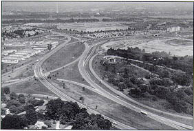
Photo image of the
original Shirley Highway in the Pentagon area. The Mixing Bowl interchange
with VA-27 Washington Boulevard is in the middle of the photo, and the Pentagon
is in the background, and the Potomac River and the Washington Monument is
in the distance. Photo by U.S. Bureau of Public Roads, 1954. |
The remainder of Shirley Highway from US-1 just north of Woodbridge to VA-7 was built by the Virginia Department of Highways (VDH) from 1945 to 1952. It also was built to 4-lane full freeway standards, same as the section from VA-7 to the Highway Bridge. My research has resolved the seeming anomaly where some current (1990s) official media has reported both September 1949 and May 1952 as the completion month-year depending on the article that you read. The whole Shirley Highway was built in a stage construction manner as funds became available; keep in mind that in the 1940s there was no federal Highway Trust Fund (the HTF was established in 1956), and large scale non-toll highways had to compete for scarce funding with many other highway projects. The original plan was to build the whole 17-mile-long highway to full freeway standards at once, with 6 lanes on the portion north of VA-7 Alexandria-Leesburg Highway, and with 4 lanes on the portion south of VA-7. Instead, due to funding limitations, it was built incrementally as funds became available, with the 6-laning being deferred indefinitely, and with 4 lanes built north of VA-644 at Springfield, and with an initial 2 lanes with 2-way traffic built on a 4-lane right-of-way south of Springfield; and this was the configuration that was completed in September 1949, with large trucks banned. Soon after this was completed, the funding was found to build the 2-lane parallel northbound roadway from Springfield southward, and this was completed on May 24, 1952, completing the Shirley Highway to full 4-lane freeway standards with mixed traffic of cars, buses and large trucks being facilitated on the new highway. So Shirley Highway was in fact completed along its whole 17.3-mile length on September 6, 1949, but it wasn’t a 4-lane freeway throughout until May 1952, and didn’t carry large trucks throughout until May 1952, and thus didn’t provide its original function of providing a US-1 bypass for all types of vehicles until May 1952. Actually, there was a controversy where certain civic groups and individuals in Northern Virginia protested opening the highway to large trucks upon completion, on the grounds that the trucks would “slow down and endanger the flow of traffic”, but they were overruled by state and federal officials who rightly concluded that the through trucks would be much safer on Shirley Highway, a freeway, instead of on the old US-1, a congested 4-lane highway without access controls. The entire Shirley Highway was paved with reinforced portland cement concrete pavement on a heavily stabilized base, designed to handle heavy military, commercial and commuter traffic. [1, 5, 9, 33]
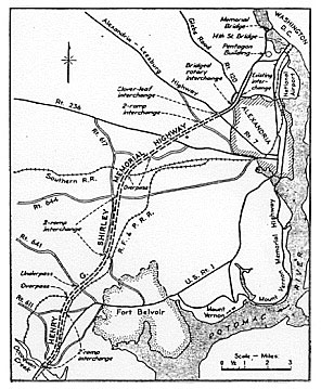
Map image showing
the route of Shirley Highway (planning name was Fort Belvoir Bypass). Map from “The Henry G. Shirley Memorial Highway”, by A.H. Bell, Location and Design Engineer, Virginia Department of Highways, published in the Virginia Road Builder, January 1946. [2] Click for larger map image: Large (205K). Use "Back" button to return.
|
The Pentagon Road System has also been referred to as the Pentagon Road Network, and initially it was referred to as the War Department Building Road Network.
I have a copy of “A
History of the Pentagon Road System and Shirley Memorial Highway”, from the
Pentagon Area Transportation Study, Appendix A, “Statement of Historical Reference
Relating to the Development of the Pentagon Road System and the Connecting Shirley
Memorial Highway”, F.W. Cron, Regional Engineer, Region 15, Bureau of Public Roads,
October 24, 1960. This history document is contained in a memorandum “History
of the Pentagon Network”, from F.W. Cron, U.S. Department of Commerce, Bureau
of Public Roads, October 25, 1960.
Excerpt in blue text from the first 4-1/2 pages of the document:
A History of The Pentagon Road
System and Shirley Memorial Highway
The War Department Building Road
Network, sometimes referred to as the Pentagon Road System, had its origin in
a decision by the Congress in 1941 to construct an office building for the War
Department to improve the efficiency of its headquarters operations, which were
housed in numerous offices throughout the area.
Prior to this, the inadequacy of
roads approaching the Potomac River bridges had given highway officials much concern,
and in January 1934 the Commissioner of Public Roads prepared a report on the
situation for the National Capital Parks and Planning Commission. This report
resulted in a plan for a system of arterial highways to be used as a basis for
a progressive program of improvements. This plan was approved by the Commission
in 1934.
There were three major objectives in the program of improvements proposed in 1934: The first was relief from increasing traffic congestion resulting from the increasing number of vehicles using the bridges across the Potomac for travel from the District of Columbia to points in Arlington and Fairfax Counties, the City of Alexandria, and beyond. The second objective was to improve the southerly and westerly approaches to Washington. These routes, built on narrow rights-of-way and lacking control of roadside development, were lined with gas stations, hot-dog stands, and other businesses of a character undesirable on the principal approaches to the Nation's Capital. A third objective was expansion and protection of the Arlington National Cemetery by elimination of Arlington Ridge Road, which at that time constituted the eastern boundary of the Cemetery. By constructing a bypass east of the Ft. Myer South Post and the Arlington Experimental Farm, the Arlington Ridge Road could be abandoned and these areas incorporated in the Cemetery.
Through the years these objectives
became increasingly important, but little was done to realize them. In 1941 the
traffic across the Memorial, Key, and Highway bridges had reached an average weekday
total of 118,000 vehicles per day, with an hourly peak load close to 11,000 vehicles.
The bridges were not the critical points of congestion. The bottlenecks
were the approaches, which were inadequate to accommodate these loads. The
improvements contemplated a decade earlier, of which only the improvement of Lee
Boulevard had actually been completed, were now sorely needed. The prospect
of providing access for 40,000 additional workers housed in one building now promised
a radical change in the highway traffic volume and pattern.
In March
1941, a revised general layout was prepared. This plan was not materially different
from the arterial highway plan of 1934, except for the addition of a number of
grade separation structures and a
new route to the south, bypassing Alexandria, Ft. Belvoir, and old U.S. Route
1, later known as the Shirley Memorial Highway.
The First Supplemental Civil Functions Appropriation Act of 1941, approved October 9, 1940, provided funds for Federal Office Building No.2 (now known also as the “Navy Annex”). A site for this building between Columbia Pike, Arlington Ridge Road, and the Arlington National Cemetery, was selected and construction was undertaken in December 1940, on a building expected to house 7,500 workers.
In the First Supplemental National
Defense Appropriation Act of 1941, approved August 25, 1941,
$35,000,000 was appropriated
"For the construction of and use by the War
Department on Government-owned land comprising the site formerly occupied by the
Department of Agriculture Experimental Farm and land adjacent thereto in Arlington
County, Virginia, of an office building and appurtenances thereto, including interior
facilities, fixed equipment, necessary services, roads, connections to water,
sewer, gas and electric mains, preparation of an automobile parking area, purchase
and installation of telephone and radio equipment, and similar improvements. ...”
In the committee report on the bill, dated July 24,
1941, it was stated among other things that the building
would provide office space for 40,000 workers, and that the cost of the project
would include $1,000,000 for a paved parking area for 10,000 automobiles.
The site originally
proposed for this building was directly east of the main gate to Arlington Cemetery
and facing on both Memorial Avenue and Arlington Ridge Road. The angle between
these roads was such as to suggest two sides of an irregular pentagon, and these
early studies indicated a pentagonal shape for the proposed building. Farther
south, in what is now called Ft. Myer South Post, a mammoth Quartermaster Depot
was proposed.
From the start, objections were raised to the Memorial Avenue site on the grounds that a building of such large size so close to Arlington Cemetery would detract from the memorial character of the Lincoln Memorial, Memorial Bridge, and Arlington Cemetery, and further would preclude the future expansion of the cemetery to the east. It was also believed that transportation problems would arise, causing congestion on Memorial Bridge. In September 1941, at the suggestion or Mr. Jay Downer, noted highway engineer and planner, retained as a consultant by the National Capital Park and Planning Commission, then chaired by Mr. Frederick Delano, the site for the building was moved southward to the present location, displacing the proposed Quartermaster Depot on which construction had just begun. (This depot was later constructed near Cameron Run in Alexandria.) At the suggestion of President Roosevelt, the original pentagonal shape was retained in the new location, and eventually "The Pentagon" became the official name of the building.
In August 1941, in anticipation of the approval by Congress of the act authorizing the new War Department office building, the War Department advised the Commissioner of Public Roads that roads serving the proposed building would receive high priority under the Defense Highway Act of 1941, and requested that Public Roads design and construct these roads, concurrently with the construction of the building, using funds to be appropriated by the Defense Highway Act of 1941.
On September 10, 1941, upon request of the War Department, the Federal Works Agency undertook to lay out, design, and supervise the construction of the highway network in the general vicinity of the new War Department building. This agreement, confirmed October 8, 1941, provided that the PRA would design and construct all roads except those used by buses, taxis, trucks, and cars for access from the main roads to the building and parking areas. On September 17, 1941, the Commissioner of Public Roads contracted with an engineering firm of Washington, D.C., for an accurate topographic base map of the area, including the proposed improvements, for delivery within 30 days. While this map was in preparation, planimetric studies of various road layouts were being made by the PRA and the Chief Architect for the building. By October 2, 1941, these studies had crystalized the highway plan in essentially its final form.
This plan, entitled “Proposed Highway
System, War Department Building, Arlington, Virginia, Dwg. No. 7185-7001, Oct.
2, 1941”, as sent on October 8, 1941, to the following for comment and approval:
Chairman, National Capital Park and Planning Commission
Director, National Park Service
Commissioner, Virginia Department of Highways
County Manager, Arlington County, Virginia
Director of Highways, District of Columbia
None of these agencies was completely in agreement with the plan presented by the Commissioner of Public Roads; however, agreement in principle was reached with most of them in the remarkably short period of two months.
[end of excerpt from
Bureau of Public Roads memorandum, October 25, 1960]
The above BPR memorandum listed the highways in the Pentagon Road Network as
built 1941-1952 by the federal government with Defense Access funds. This
is the system as was transferred to the Virginia State Highway Commission in 1964.
1) US-1, 0.7 mile (northernmost section of Shirley Highway)
2) The Shirley Highway (VA-350) from US-1 to VA-7, 4.0 miles
3) Jefferson Davis Highway Extension from US-1 to Arlington Boulevard, 2.0 miles
(today’s VA-110)
4) Connecting road, between the Shirley Highway and Arlington Ridge Road, 0.2
mile
5) Connecting road, from the Shirley Highway to Arlington Boulevard, along the
south boundary of Fort Myer, 1.3 miles (today’s VA-27 Washington Boulevard)
6) Connecting road, from Shirley Highway to Columbia Island, 1.0 mile (today’s
VA-27 Washington Boulevard for Memorial Bridge traffic)
7) Columbia Pike Extension, from old Arlington Ridge Road to connecting road between
Shirley Highway and Boundary Channel, 0.4 mile
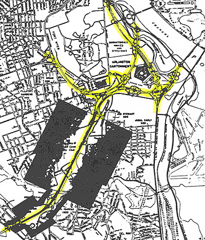
Map image showing the Pentagon Road Network
(highlighted by me in yellow marker), from “Housing Development and Express
Highways”, testimony presented by Thomas H. MacDonald, Commissioner of U.S.
Public Roads Administration, before the Subcommittee on Housing for the Post-War
Period, January 11, 1945. [1] Click for larger map image: Large (431K). Use "Back" button to return. |
Well before the Pentagon Building was conceived, the inadequacy of the roads
approaching the Potomac River bridges from the south had given highway officials
much concern, and in January 1934 the Commissioner of U.S. Public Roads Administration
prepared a report on the situation for the National Capital Parks and Planning
Commission (NCPPC), and this report had a plan for a system of arterial highways
that would be developed progressively, and the plan was approved by NCPPC in 1934.
This plan laid the foundation for the Pentagon Road System that was approved for
development in 1941.
As discussed in the cited material above, in March 1941 a revised general layout
was prepared that was almost the same as the 1934 plan, except that a number of
highway grade separation bridges were included, as well as a new route to the
south, bypassing Alexandria, Fort Belvoir and US-1, the highway which later came
to be known as Shirley Highway. On August 25, 1941, the U.S. Congress appropriated
the funds to build the War Department Building (Pentagon) complex. On September
10, 1941, the U.S. Public Roads Administration undertook the project to design
and administer the construction of the network of roads and highways in and around
the Pentagon complex, and on October 2, 1941 an official plan for the highway
system had been completed.
The U.S. Public Roads Administration assembled a team of engineers from around
the U.S. to design the network, and the design team worked in the Washington Office
of PRA. The design objective was to find solutions to the problems encountered
when upon an already congested road system, there was superimposed a new road
pattern and the high traffic generated by three new planned government office
buildings (the Pentagon, the Navy Annex, and the temporary office building for
the Air Corps at Gravelly Point) designed to provide space for over 55,000 employees,
which was equivalent to serving the working population of a city of 150,000 population.
The final design of the road network consisted of 17 miles of one-way highway
roadways, 7.7 miles of one-way ramps, 21 grade separation bridges, and several
miles of service roads that connected the highways to the Pentagon and its parking
lots.
Traffic analyses were conducted for both war times and normal
times, and the number of lanes was determined both by traffic analysis and in
relation to the number of lanes on the existing and potential bridges over the
Potomac River. This analysis assumed the eventual replacement of the Highway
Bridge with a new 6-lane bridge, and upgrades to the approaches to the Key Bridge
to increase its capacity, but it did not assume any new Potomac River bridges
upstream of the Highway Bridge (14th Street Bridge). The Pentagon network
design provided essentially direct routes for all major traffic movements between
the perimeter of the design area, and the three Potomac River bridges then in
existence (14th Street, Memorial and Key).
The Pentagon Network was built quickly, and for most of the project there was
design and construction underway concurrently on various parts of the complex.
The speed of development didn’t preclude provisions for esthetics, though, with
provisions for landscaping and grassing and attractive stone treatment on the
bridges. Acquisition of right-of-way was initially handled by the War Department,
and later by the U.S. Public Roads Administration. There were a considerable number
of buildings which had to be demolished and removed from the right-of-way, including
a considerable number of sub-standard and low-income housing units.
Construction contracts were awarded from a competitive bidding process, and
grading operations began in October 1941. Over 3 million cubic yards of
excavation was needed for the highway network, and about 1/2 of that was material
for embankment, obtained from borrow pits in D.C. and Arlington. Work on
all of the grading contracts was completed in October 1944. The first bridge
project was awarded on November 28, 1941, and work on the last of the 17 bridges
was completed on July 7, 1944. The first paving contract was awarded on
March 20, 1942, and that and six other paving contracts were completed by September
15, 1943. So a workable highway network was complete in October 1943, and
the Pentagon Building was completed on January 15, 1943 (the first occupants moved
in on April 29, 1942). Before the new highway network was completed, construction
and employee traffic had Columbia Pike and US-1 Jefferson Davis Highway, for available
access to the Pentagon site.
Detailed information about the planning and construction of the Pentagon Building is in the article "The Pentagon Building (1941-1943)", from The History and Heritage of Civil Engineering in Virginia, by J.C. Hanes and J.M. Morgan, Jr., 1973, Virginia Section of American Society of Civil Engineers.
World War II began for the United States on December 7, 1941, and as the tempo
of the war increased, the Pentagon and PRA contractors had more difficulty obtaining
needed material for the projects, and some of the original design was ordered
to be deferred, including the proposed lighting of the entire road network, a
few ramps, and a bridge on a side road. After the war ended, work resumed
to complete the miscellaneous elements needed to complete the 1941-approved network,
and all that work was completed by 1952, although the originally planned lighting
system was not installed. Altogether, PRA (later Bureau of Public Roads)
awarded 47 individual contracts connected with the War Department Building Road
Network, with the first awarded November 28, 1941 and the last completed on February
2, 1952, and the total expenditure was $8,512,133.
The section of Shirley Highway from
VA-7 to the beginning of the Pentagon Road Network at Arlington Ridge Road, started
out as a Virginia Department of Highways project (the rest of Shirley Highway)
that was under study at the same time as when PRA and the War Department were
engaged in studies for the Pentagon Road Network. In September 1942, this
section was certified as a Defense Access Road project by the War Department,
and PRA was instructed to build it. The same PRA project design office that
administered the Pentagon Road Network, was in charge of this project. This
was designed as a 6-lane divided highway built to full freeway standards and a
70-mph design speed, but due to the exigencies of war and the urgent need to complete
the highway as an access to large defense housing developments, it was built in
stages with 4 lanes on Shirley Highway and an at-grade railroad crossing instead
of a bridge over the Washington and
Old Dominion Railroad just north of Shirlington Circle. The first grading
contract was awarded on April 14, 1943, and the southbound 2-lane roadway was
opened to 2-way traffic on October 23, 1943, and the northbound 2-lane roadway
was opened on October 30, 1944, thus completing the 4-lane freeway. The
cost for this section was $356,558 for right-of-way and $1,268,691 for construction.
This in conjunction with the Shirley Highway portion of the Pentagon Road Network,
completed the 4 miles of Shirley Highway from VA-7 to the Highway Bridge (14th
Street Bridge) by October 1944. So it can be seen how wartime priority was
placed on getting Shirley Highway and its interchanges completed as quickly as
possible, from VA-7 to D.C.
The post-war period resulted in continually increasing traffic demands on the Pentagon Road Network and Shirley Highway. The Virginia Department of Highways extended Shirley Highway southward to US-1 just north of the Occoquan River just north of Woodbridge, with completion on May 24, 1952. [33]
Construction of the original Shirley
Highway spanned from 1941 to 1952 before the entire highway and its interchanges
was completed to full freeway standards.
VA-7 to D.C. – Begun in October 1941.
The Shirley Highway portion opened October 1943, mostly 2 lanes. Shirley
Highway was completed to 4 lanes divided in October 1944. The last element
of the interchange complex wasn’t completed until February 1952. All built
by US PRA/BPR.
Shirley Highway in the 1950s – Early Years of Completed Highway
The District of Columbia
built the 4-lane Rochambeau Memorial Bridge for northbound traffic at the Highway
Bridge (14th Street Bridge), and it opened on May 9, 1950, relegating the Highway
Bridge to southbound traffic. This is the bridge complex that carries Shirley
Highway traffic and US-1 traffic into and out of D.C. The old steel truss Highway
Bridge was demolished and removed after the replacement 4-lane George Mason Bridge
was opened in 1962.
With the rapid growth of the D.C. suburbs
after World War II and on into the 1950s, it didn’t take long before traffic growth
outstripped the capacity of Shirley Highway, especially on the section in Arlington
from VA-7 to D.C., which had originally been planned as needing 6 lanes but which
was scoped down to 4 lanes because of the exigencies of war and the need to complete
it along with the Pentagon Building as quickly as possible during wartime.
With the completion of Shirley Highway in its entirety from Woodbridge to D.C.
in 1952, even more traffic growth was facilitated as the full US-1 bypass now
existed, and as more housing developments were built in the corridor from Woodbridge
to D.C.
In 1954, 1955 and 1956, there were
negotiations between the U.S. Bureau of Public Roads (BPR) and the Virginia Department
of Highways (VDH), to transfer ownership and administration of the Pentagon Road
Network and Shirley Highway from VA-7 to the 14th Street Bridge, from BPR to VDH.
The Virginia State Highway Commission approved a resolution on March 24, 1955,
to accept a BPR proposal to carry out this transfer. Legislation was introduced
in the U.S. Congress in 1956 and 1958 to approve the transfer, but the bill was
never enacted. On September 24, 1959, the Virginia State Highway Commission
rescinded its resolution of March 24, 1955. As I will go into more detail
on later in this article, this transfer was not finally enacted until 1964 when
the Interstate reconstruction was about to begin on that section of Shirley Highway.
Shirley Highway in the 1960s - Planning and Beginning the
Reconstruction
The preliminary plan was that the southern half of Shirley Highway would be widened to 6 lanes and the northern half to 8 lanes, with the interchanges being upgraded to cloverleaf and modified cloverleaf designs, and with the Mixing Bowl interchange at Washington Boulevard being converted to a semi-directional interchange. The expanded highway would be designed to Interstate standards, and it would be designated as I-95 when completed. Soon afterward,
a 2-lane express reversible roadway was added to the design concept, from Springfield to D.C., and the District of Columbia Department of Public Works proposed a third 14th Street Bridge to carry this express traffic into and out of D.C. The express reversible roadway would be in addition to the two directional general purpose roadways, and would be reversed to flow in the direction of peak period traffic, inbound to D.C. in the morning peak and outbound from D.C. in the evening peak, and express in the sense that it has infrequent access and egress ramps. The original plan was that the reversible roadway would carry all types of vehicles at all times. The High Occupancy Vehicle (HOV) restrictions that it had from its completion in 1975 until the present, was a result of planning efforts and a change in operational philosophy later in the 1960s.The design of the widening and construction
program was contracted by the Virginia Department of Highways to the engineering
consultant Howard, Needles, Tammen and Bergendoff (HNTB).
HNTB was and is
an experienced and widely known engineering firm that has designed many large-scale
highway projects in the U.S. HNTB prepared preliminary and final designs for the
widening program, and divided it into 9 separate projects for construction contract
awards. Construction began at the south end of Shirley Highway, and the
contract awards advanced successively northward to the Potomac River. The
original schedule was for construction to start in 1963 and for all construction
to be complete in 1967 or 1968, with a total cost of $62 million. The reason
for starting at the south end was that that it was simpler and less costly to
start at that end, with early construction able to cover many more miles of highway;
also for the reason that the transfer of the Pentagon Road Network was a complex,
drawn-out process that hadn’t occurred yet when the widening program was ready
to begin, and the joint plan by VDH and FHWA was for the transfer to Virginia
to take place before the VDH administered widening projects began on the 3 projects
on that section (VA-7 to 14th Street Bridge).
A variety of automated features were
planned and incorporated into the design of the reconstructed Shirley Highway,
and were trend-setting for the time that they were first proposed in the early
1960s. This included high-level continuous roadway lighting, variable message
signs, electronic gates, electronic traffic sensors, television surveillance,
ramp metering, and a central control headquarters that operates these systems.
Much of this was deferred until after the widening and reconstruction of the highway
was completed in 1975, but a project completed in June 1985 provided a traffic
management system [TMS] that provides all of these features. The high-level continuous
roadway lighting was included in each widening project. [12, 15]
The early planning for the 2-lane reversible
roadway included discussions for accommodating express transit bus service. A
study in 1964 looked at the possibility of providing bus stops at some of the
interchanges, but this scheme was later deemed to be impractical. [13]
Construction moved fairly rapidly on the 13 miles of Shirley Highway from north of Woodbridge to just north of VA-7, with the first project starting in 1965 and the last being completed in 1968. Cost estimate increases due to inflation, delays in getting the needed state and federal highway appropriations, delays in finalizing the transfer of the Pentagon Road Network (which occurred in 1964), and delays by the Interstate Commerce Commission (ICC) in allowing the Washington and Old Dominion Railroad to go out of business (which occurred in 1968), thereby resolving the issue of what to do about the at-grade W&OD railroad crossing on Shirley Highway just north of Shirlington Circle -- all these delayed the final three projects on the 4 miles from VA-7 to the 14th Street Bridge. Construction contract awards advanced from south to north, with the Shirlington Project built from 1969-1972, the Mixing Bowl Project built from 1970-1973, and the Expressway Project built from 1972-1975, and the combined cost of these three projects was $87 million, with $52 million for the Mixing Bowl Project itself. At that time, the Mixing Bowl Project was the most expensive contract in the history of the Virginia Department of Highways.
The whole 17.6-mile-long Shirley Highway widening and reconstruction program spanned from 1965 to 1975, and the final cost was $162 million. The costs stated above include design, right-of-way
acquisition, and construction.See my article Shirley Highway Busway/HOV System for a detailed Virginia Highway Bulletin July 1974 article about the busway/HOV system and the reconstruction of Shirley Highway.
Transfer of
Pentagon Road
System From Federal Government to Virginia
As I wrote earlier,
in the mid- to late 1950s, there were negotiations between the U.S. Bureau of
Public Roads (BPR) and the Virginia Department of Highways (VDH), to transfer
ownership and administration of the Pentagon Road Network from BPR to VDH. These
negotiations were not completed, and ended in 1959. With the impending reconstruction
of Shirley Highway, negotiations began again in the early 1960s, with the transfer
agreement being completed and the jurisdiction of the system being transferred
to the Virginia State Highway Commission (today's Commonwealth Transportation
Board) on December 17, 1964. Interestingly, 22 miles of I-95 just north of Fredericksburg
opened the next day, December 18, completing I-95 between Richmond and Washington
(assuming that Shirley Highway served as a temporary I-95 until it was reconstructed
1965-1975). [14]
The general details are in this article, and I plan on adding more in-depth details later from various news articles 1966 and after, about the reconstruction of Shirley Highway.
The interchange between Shirley Highway and the Capital Beltway (I-95, I-395, I-495) and between VA-644 and I-95, is being reconstructed and expanded. See my article Springfield Interchange Project. See the official VDOT website Springfield Interchange Improvement Project.
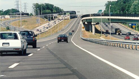
I-95 near Dale City, Va., looking north,
taken June 1997. The center reversible roadway was extended from Springfield to
Dumfries, 19 miles; construction spanned from 1989 to 1997, cost was $305 million.
It carries HOV-3 traffic in the rush hour direction, unrestricted traffic otherwise.
This section of I-95 was originally completed in 1964 and is actually south of
the Shirley Highway portion. Notice the crossover ramps from each general-purpose
roadway to the reversible roadway. "HOV-3" means that High Occupancy Vehicles
with three or more people can use the road; those with fewer cannot.
The establishment of the reversible 2-lane busway/HOV roadway system on Shirley Highway followed this sequence: The concept originated in 1964, was implemented in 1969 as the first exclusive bus facility on a U.S. urban freeway, and was completed from Springfield to downtown D.C. in 1971 albeit via a temporary one-lane roadway through the reconstruction of the northernmost several miles of the highway in Arlington. On December 10, 1973, automobiles with four or more occupants (HOV-4) were permitted access to the previously exclusive bus lanes at a few selected access points. In July 1975, the 10-year-long staged reconstruction and expansion of Shirley Highway was completed, and the full 2-lane express reversible roadway was completed, and the express traffic uses the 4-lane (2 lanes each way) center bridge of the 14th Street Bridge to cross the Potomac River into and out of the District of Columbia.
In January 1989, HOV-3 went into effect on I-395/I-95. In June 1989, construction began on the 19-mile-long extension of the reversible 2-lane HOV roadway from Springfield to Quantico Creek. In December 1991, interim concurrent flow HOV lanes opened on six miles of I-95 shoulders, from US-1 to VA-644, with 18 emergency pulloffs available for motorists. In June 1992, the Franconia/Springfield Parkway opened to traffic, giving HOV/busway vehicles direct access between the I-95 HOV lanes and the Parkway. In September 1992, motorcycles were given legal access to all HOV facilities in Virginia. In November 1994, the reversible HOV roadway was extended from Springfield to one mile south of Newington. In June 1995, the reversible HOV roadway was extended to Occoquan. In January 1996, the reversible HOV roadway was extended to Optiz Blvd. In June 1997, the reversible HOV roadway was extended to south of VA-234. Thirty miles of 2-lane reversible HOV roadway now exists on I-95 and I-395 between south of VA-234
in Prince William County, and 14th Street and the Southwest Freeway in Washington, D.C.The official VDOT website has web pages with details about Virginia HOV Systems.
An I-95 widening project is planned in Fairfax County and Prince William County, the I-95 Fourth Lane Widening Project. The 6.3-mile-long project entails the provision of an additional fourth lane on the outside of northbound and southbound I-95, between VA-123 in Prince William County and VA-7100 in Fairfax County. The new northbound fourth lane will match the existing fourth lane just south of Accotink Creek, and the HOV roadways will be unaffected by this project. There are four interchanges which will require modified ramps to tie into the widened roadway. These interchanges are Gordon Boulevard (VA-123), Richmond Highway (US-1), Lorton Road (VA-642), and the Fairfax County Parkway (VA-7100). There are ten bridges that will be widened under this project, five of which are over the waterways of the Occoquan River, Pohick Creek, and Accotink Creek. The remaining five bridges occur over crossroads. This project is currently estimated to cost $65 million including design engineering, right-of-way acquisition, utility relocation and construction. The project's Construction programming was deleted from the VDOT FY2002-2007 Six-Year Program due to funding cutbacks. However, the project's design is within a year from completion, and the right-of-way needs are minimal, so VDOT will be ready to build this much needed project should next year's Six Year Program have funding for this project. The current 8-lane (3-2-3) I-95 highway south of VA-7100 will be widened to 10 lanes (4-2-4), the result will be 10 lanes (4-2-4) on I-95 from VA-123 at Woodbridge to the Springfield Interchange (I-95/I-395/I-495).
SlugVirginia and - Slug-Lines - Free Commuter Carpools - Slugging is not exactly hitchhiking but not quite a carpool. Some call it "Casual Carpooling". This unique method of commuting in Northern Virginia thrives without government regulation. The process is quite simple. People need extra riders to qualify for the minimum occupancy threshold to get into the High Occupancy Vehicle (HOV) lanes and other folks need a ride to work. Riders line up in lines at bus stops called Slug Lines and drivers pick up those going to their destination.
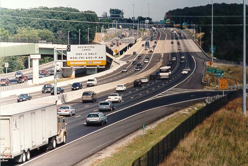
Recently widened I-95, looking northbound,
taken August 1997, from VA-123 overpass at Woodbridge. Notice the bridge where
I-95 crosses the Occoquan River; it is 868 feet long, and 11 lanes wide (8 through
lanes). The center roadway is the reversible roadway that carries HOV-3 traffic
during peak hours.
I obtained copies of many of these articles from the Federal Highway Administration in July 2002, thanks to the efforts of FHWA historian Richard F. Weingroff.
[1] “Housing Development and Express
Highways”, testimony presented by Thomas H. MacDonald, Commissioner of U.S. Public
Roads Administration, before the Subcommittee on Housing for the Post-War Period,
January 11, 1945.
[2] “The Henry G. Shirley Memorial Highway”, by A.H. Bell, Location and Design
Engineer, Virginia Department of Highways, published in the Virginia Road
Builder, January 1946.
[3] “Virginia’s First Expressway Embodies Latest Geometric Design Features”,
Concrete Highways and Public Improvements, Winter 1948.
[4] “Virginia’s First Expressway”, American Motorist, American Automobile
Association, March, 1949.
[5] “Shirley Highway, Speedy New Route From District South, Will Open Labor Day”,
newspaper The Evening Star, July 25, 1949.
[6] “Henry G. Shirley Memorial Highway”, by R.I. Mount, District Engineer, Virginia
Department of Highways, Culpeper District, published in the Virginia Road
Builder, September-October 1949.
[7] “Shirley Memorial a Model of High-Type Design”, by R.I. Mount, District Engineer,
Virginia Department of Highways, Culpeper District, published in Better
Roads, September 1949.
[8] “The Shirley Memorial Highway”, Virginia Road Builder, July-August
1950.
[9] “The Shirley: Final Stage”, Highway Bulletin, Virginia Department
of Highways, April 1951.
[10] “A History of the Pentagon Road System and Shirley Memorial Highway”, from
the Pentagon Area Transportation Study, Appendix A, “Statement of Historical
Reference Relating to the Development of the Pentagon Road System and the Connecting
Shirley Memorial Highway”, F.W. Cron, Regional Engineer, Region 15, Bureau of
Public Roads, October 24, 1960. This history document is contained in a
memorandum “History of the Pentagon Network”, from F.W. Cron, U.S. Department
of Commerce, Bureau of Public Roads, October 25, 1960.
[11] “Fund Allocated for Work on Shirley Highway”, newspaper The Evening
Star, March 21, 1963.
[12] “Automated Shirley Highway Promised”, newspaper The Evening Star,
March 4, 1964.
[13] “Bus Stations For Shirley Under Study”, newspaper The Evening Star,
May 25, 1964.
[14] “Federal Road Network Transferred to State”, newspaper Richmond Times-Dispatch,
December 18, 1964.
[15] “Shirley Highway to Regain ‘Most Advanced’ Title”, newspaper Washington
Star, April 25, 1965.
[16] “Help for the Mixing Bowl”, newspaper Washington Star, August
18, 1966.
[17] “State Proposes Highway Compromise”, newspaper Richmond Times-Dispatch,
January 11, 1967.
[18] “State Wins Pentagon Road War”, newspaper Washington Star,
January 31, 1967.
[19] “Unsnarling Interstate Traffic”, Engineering News-Record magazine,
May 4, 1967.
[20] “Shirley Work Halts at the Crossing”, newspaper Washington Star,
July 6, 1967.
[21] “Shirley Highway Widening Lags”, newspaper Washington Post,
August 3, 1967.
[22] “Bureau of Roads to Finance Shirley Highway Bus Study”, FHWA news release,
June 16, 1968.
[23] “Virginia Road Unit Buys Hot Shoppes At Twin Bridges”, newspaper Washington
Star, October 5, 1968.
[24] “Fund Shortage Delays Work on Shirley Highway”, newspaper Washington
Star, May 7, 1969.
[25] “Buses to Run Monday in Shirley Express Lanes”, newspaper Washington
Star, September 17, 1969.
[26] “Shirley Bus Lanes Extension Backed by Area Council”, newspaper Washington
Star, December 31, 1969.
[27] “U.S. to Aid Bus project for
Shirley Highway”, newspaper Washington Star, November 14, 1969.
[28]
"The Mixing Bowl Project (1970-1973)", from
The History and Heritage of Civil Engineering in Virginia,
by J.C. Hanes and J.M. Morgan, Jr., 1973, Virginia Section of American Society
of Civil Engineers.
[29] "The Pentagon Building (1941-1943)", from
The History and Heritage of Civil Engineering in Virginia, by J.C.
Hanes and J.M. Morgan, Jr., 1973, Virginia Section of American Society of Civil
Engineers.
[30]
"Huge Three-Level
Interchange Eliminates Traffic Weaving",
Engineering
News-Record, June 28,
1973 edition.
[31] “Unscrambling the Mixing Bowl”,
Douglas B. Fugate, State Highway Commissioner, Virginia Department of Highways,
American Highways, October 1970.
FHWA By Day, January 11,
1945, excerpt (blue text):
Commissioner Thomas MacDonald testifies
on "Housing Developments and Express Highways" before the Subcommittee on Housing
for the Post-War Period. Using the Shirley Memorial Highway in northern Virginia
as an example, he shows how the "location and development of modern housing projects
and the provision of express highways are closely interrelated.
See the link for a 1945
photo of the rotary interchange at what is now called Shirlington (not Seminary
Road).
FHWA By Day, September 6,
1949, excerpt (blue text):
Extension of the Shirley Memorial
Highway -- a 17-mile, four-lane expressway -- opens from a point south of the
Pentagon highway network to Woodbridge, VA. The highway is named for the Virginia
Highway Commissioner Henry G. Shirley, who died on July 16, 1941, just a few weeks
after giving the "go ahead" for work on the expressway.
See the link for a 1943 photo of the bridges carrying the rotary interchange over
Shirley Highway near Parkfairfax, now called Shirlington. That bridge's architectural
design is typical of that of the bridges on the original Shirley Highway.
I-395 Henry G. Shirley Memorial Highway by Mike Hale. Information and exit list.
Washington and Old Dominion Railroad by Paul McCray.
Rubber Tire Transit: A Viable Alternative to Rail, by Thomas A. Rubin and James E. Moore II, Reason Public Policy Institute,
Policy Study No. 230, August 1997. The report cites the Shirley Highway HOV lanes.The History of the Pentagon Building Features, from Pentagon Renovation Program, U.S. Department of Defense.
Old road, and same old problem / Traffic congestion is still snarling Shirley Highway, by Richmond Times-Dispatch, June 13, 1999. The reporter cited my comments about Shirley Highway.
Interstate 395 - Virginia/District of Columbia - Roadtrip with photos from AARoads.com.
History of the Shirley Highway (I-395/I-95), by SlugVirginia.
Springfield Mixing Bowl Tosses Up A Medly of Challenges, by Engineering News-Record magazine, May 6, 2002.
MixingBowl.com - traffic information in the Washington, D.C. area.
The Mixing Bowl: It’s big, it’s busy, but it’s no Taj Mahal, by
Virginia Business - October 2001.For more details, see my articles --
Mixing Bowl Interchange Complex
Shirley Highway Busway/HOV System
Springfield Interchange Project
Interstate 95 in Virginia
Interstate 395 in Virginia
Interstate 495 in Virginia
14th Street Bridge Complex (I-395 and US-1)
PRA - U.S. Public Roads Administration
BPR - U.S. Bureau of Public Roads (formerly was PRA)
FHWA – Federal Highway Administration (formerly was BPR)
D.C. - District of Columbia
VDH - Virginia Department of Highways
VDOT - Virginia Department of Transportation (formerly was VDH)
HNTB - Howard, Needles, Tammen and Bergendoff
All photos by Scott Kozel unless otherwise credited.
Copyright © 1997-2005 by Scott Kozel. All rights reserved. Reproduction, reuse, or distribution without permission is prohibited.
By Scott M. Kozel, Roads to the Future
(Created 8-14-1997, updated 11-1-2002, minor updates 2-13-2005)