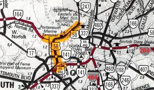
Midtown Tunnel history from VDOT in 2005:
The Norfolk-Portsmouth Tunnel, known as the second tunnel, is called the Midtown
Tunnel. This tunnel is a single two-way tube beneath the main channel of the Elizabeth
River between Norfolk and Portsmouth. The Midtown Tunnel opened September 6, 1962.
The length of the Midtown Tunnel, from the entrance to the exit, is 4,194 feet.
The lowest point of the Midtown Tunnel is 87.8 feet below mean low water. Annual
average daily traffic (AADT) was 8,400 in 1963, the Midtown Tunnel's first complete
year of operation; today the AADT is over 46,000 (AADT was 39,000 in the 1995
VDOT traffic volumes book, and 46,000 in the 2001 VDOT traffic volumes book),
and it is the busiest two-lane highway in Virginia. All tolls were removed from
the tunnel on August 1, 1986.
The Western Freeway, Virginia Route 164
,
was first proposed in a regional transportation study in 1965, was included in
regional transportation plans from then onward, and it was completed from I-664
and US-17 at Churchland in the City of Suffolk to Port Norfolk in the City of
Portsmouth in 1992. This includes the 3,630-foot-long high-level West Norfolk
Bridge over the Elizabeth River Western Branch, which was completed in 1979 as
the first Western Freeway segment to open, 1.2 miles of VA-164 between West Norfolk
Road and Bayview Boulevard including the bridge, and this first segment of the
Western Freeway was accelerated in schedule because the original West Norfolk
Bridge was wearing out and needed to be replaced soon, and the highest part of
the current bridge provides 45 feet of vertical navigational clearance and 100
feet of horizontal navigational clearance over a marine channel. The rest of VA-164
west of the West Norfolk Bridge was built 1986-1992. The original West Norfolk
Bridge was a low-level narrow two-lane wooden bridge with a drawspan, the bridge
was built in the 1920s, and its south end was at Bayview Boulevard close to the
south end of the new bridge, and its north end was at Prospect Avenue about 1/2
mile east of the north end of the new bridge. The Western Freeway is a 4-lane
highway built to urban Interstate standards and designated as VA-164, and all
of it east of I-664 was designed with a median wide enough for future widening
to six lanes (three lanes each way with full-width left and right paved shoulders),
and also with enough additional space in the median (beyond that needed for six
lane widening) for a future relocated two-track freight railroad line, for high-speed
freight access to a future marine terminal on the Elizabeth River in the West
Norfolk section of the city of Portsmouth.
This 5-mile-long relocated freight
railroad line (of Commonwealth Railway, Inc., a Suffolk-West Norfolk short-line
railroad), between I-664/Pughsville Road and VA-164/Coast Guard Boulevard, now
utilizes a portion of the median of I-664 also, and highway mainline grade separations
were provided in the original design to provide 5 places where the railroad line
and its spurs would enter and leave the highway rights-of-way. The
construction of the West Norfolk marine terminal
was begun in April 2004 by the Maersk company, with completion in 2007. According to a VDOT engineer
who worked on the project which provides rail and road improvements
to serve the new marine terminal, the highway median relocated freight railroad
line is built to serve a future Virginia
Port Authority marine terminal which is planned to be built off of the eastern
shoreline of Craney Island; and he said that the relocated freight railroad line
would cost about $50 million to build in today's dollars. Other 2004 news articles
said that this Craney Island VPA marine terminal was planned to begin operation
in 2017, but that has not yet happened yet. A new interchange with VA-164 for
the Maersk marine terminal, was completed in January 2007.
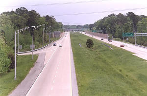 |
VA-164
Western Freeway, looking eastward from VA-135 overpass. Notice the extra-wide
median and the sound barriers. Photo by Scott Kozel, March 2004.
Click image
for large image (size 96 kilobytes). |
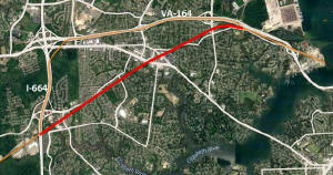 |
The relocated freight railroad line of
Commonwealth Railway, Inc., a Suffolk-West Norfolk short-line railroad,
follows the orange line along the two highways I-664 and VA-164. The
red line is the abandoned route thru Portsmouth neighborhoods.
The relocated line opened in December 2010. The $60 million project,
paid for almost entirely with federal and state funding, connects the APM
Terminals' port facility in Portsmouth to the rail systems of Norfolk
Southern Corp. and CSX Corp. in Suffolk. The relocated freight
railroad line not only provides a higher speed and higher capacity fully grade
separated line, but also provides a major benefit to the Portsmouth
neighborhoods that no longer have an at-grade freight railroad line that had
14 road crossings.
Click image
for large image (size 122 kilobytes). |
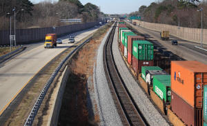 |
VA-164
Western Freeway, with the rail line built in the median. Photo
courtesy of Hive Mind.
Click image
for large image (size 298 kilobytes). |
The easternmost 1.5 miles of VA-164 was
completed in September 2005, as mentioned above; this was called the Western Freeway Extension in
planning studies and in a VDOT Location Public Hearing brochure from a Location
Public Hearing on September 26, 1979. It was more recently called the Pinners
Point Connector, and it is now called the Pinners Point Interchange (Port Norfolk
Connector) by VDOT.
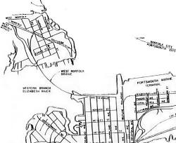 |
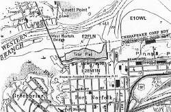 |
| This map shows the location of the current
West Norfolk Bridge that was completed in 1979. Its southern abutment is near
where the original bridge's southern abutment was, and its northern abutment
is 1/3 mile west of where the original bridge's northern abutment was. |
This map shows the location of the original West Norfolk Bridge.
It extended from Progress Street southward across the river.
Each image can be clicked for a large image.
|
| These are excerpts of maps from
the Final Environmental
Impact Statement, EIS Number FHWA-VA-EIS-89-03-F, Route 58 / Midtown Tunnel
(Including Pinners Point Interchange), approved by FHWA, 11-8-1996.
|
West Norfolk and Port Norfolk are not cities, they are neighborhoods in the
city of Portsmouth.
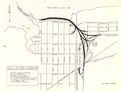 |
Here's a map scan from a September 26, 1979 VDOT Location Public
Hearing brochure for the Western Freeway Extension, showing a detailed plan
view of the alternate that was chosen later for design and construction.
The current design is similar to this, although the project
includes improvements to the MLK Freeway from VA-141 London Blvd. to near
the Midtown Tunnel portal.
|
| Click for larger map images:
Medium (97K),
Large (143K),
Extra Large (190K). |
The eventual need for a parallel Midtown Tunnel has been recognized since about
1980. Expanding the Midtown Tunnel was a second priority to expanding the Downtown
Tunnel, though.
In 1976, FHWA approval was provided for Interstate 90% federal-aid to expand
the Downtown Tunnel/Berkley Bridge complex. The expansion was started in 1982,
and the parallel 2-lane Downtown Tunnel opened in 1987, the rehabilitated original
2-lane Downtown Tunnel reopened in 1988, the I-464 Berkley Interchange opened
in 1989, and the entire project was completed in 1991, with the completion of
the parallel 4-lane Berkley Bridge, the rehabilitated original 4-lane Berkley
Bridge, and the Norfolk Interchange with I-264, Waterfront Drive, Saint Paul's
Boulevard and Tidewater Drive. This entire 2.2-mile-long highway segment cost
$250 million to expand, and became part of Interstate 264.
Downtown Tunnel history from VDOT in
2005:
The Norfolk-Portsmouth Bridge-Tunnel, known as the first tunnel, is called the
Downtown Tunnel. This tunnel consists of parallel tunnel tubes beneath the Southern
Branch of the Elizabeth River with a connecting drawbridge called the Berkley
Bridge, which extends over the Elizabeth River Eastern Branch. The first Downtown
Tunnel, which is now the westbound lanes, opened May 23, 1952. The second tube
of the Downtown Tunnel opened March 4, 1987. The length of the eastbound Downtown
Tunnel, from the entrance to the exit, is 3,813 feet. The length of the westbound
Downtown Tunnel, from the entrance to the exit, is 3,350 feet. The lowest point
of the Downtown Tunnel is 83.3 feet below mean low water. Annual average daily
traffic (AADT) was 12,900 in 1953, the Downtown Tunnel's first complete year of
operation. The AADT was over 87,000 with 9% large trucks in the 1997 VDOT traffic
volumes book, and VDOT reports AADT of 95,232 for 2003. All tolls were removed
from the tunnel on August 1, 1986.
The Parallel Midtown Tunnel / Port Norfolk Connector / Martin Luther King Freeway
Extension project was estimated in 1999 to cost about $600 million dollars. A
tremendous amount of structure work is required, not just for the new Elizabeth
River tunnel, but also for a 3/4-mile-long offshore freeway viaduct in the Elizabeth
River at Port Norfolk in Portsmouth, plus the elevated ramps at the directional Pinners Point Interchange, plus the elevated MLK Freeway extension and the interchange
with I-264, plus a complete renovation of the original Midtown Tunnel. Finding
funding of course is a challenge, and local and state officials have been studying
how to fund this needed but expensive project. It is on the National Highway System,
but to my knowledge, no proposal for Interstate system funding (90% federal funds
from the Highway Trust Fund) has ever existed for this project.
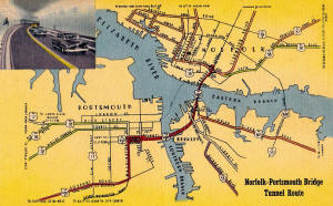 |
Downtown Tunnel and Berkley Bridge, postcard from 1952, the year that the
complex opened to traffic. Its name was the Norfolk-Portsmouth Bridge
Tunnel, the name change to the Downtown Tunnel was not needed until the
Midtown Tunnel opened 10 years later.
Click image for large image (size 430 kilobytes). |
1999 Public-Private Proposal to Fund Project
A funding proposal in June 1999 attracted a lot of attention, and it was a
proposal by a private enterprise called Hampton Roads Public-Private Development,
to provide 90% or more of the funds through private investment capital, under
the provisions of Virginia's PPTA, the
Public-Private
Transportation Act (PPTA), with the private firm recouping the investment
through revenues from the re-tolling of the Midtown Tunnel and the Downtown Tunnel.
Electronic toll collection would be used so as to avoid building traditional
toll plazas. A lot of local people thought that this proposal was a good idea,
but the city of Portsmouth had major concerns about the reinstitution of tolls;
since the Norfolk/Hampton Roads region has progressively eliminated highway tolls
because many local people believed that tolls were hindering commerce and placing
an unfair burden on the users of those facilities, and a couple economic studies
were performed by the local metropolitan planning organization in the 1970s, that
demonstrated the significant economic benefits that would accrue to the public
by eliminating the tolls on the crossings of the Elizabeth River and Hampton Roads.
A Virginian-Pilot newspaper article was published April 7, 1999,
called "Split Council In Norfolk Approaches Toll Vote". Excerpts follow (blue
text):
Tolls were proposed by a group
of private road builders, the Hampton Roads Public Private Development, under
a state law that permits such financing to accelerate road projects when state
money isn't available.
The plan calls for tolls on the Downtown and Midtown tunnels that would remain
in place for 50 years. The toll would be 50 cents for the first eight years, but
eventually increase to about $2.70. Opposition from either city could delay or
kill the road projects, including a second Midtown tunnel and expansion of Martin
Luther King Boulevard in Portsmouth. Many government and business leaders consider
a second tube critical to easing traffic congestion that could stifle commerce
and economic development in the region.
A Virginian-Pilot newspaper article was published March 25, 1999,
called "Portsmouth's Toll Stance Causes Alarm In Norfolk". Excerpts follow (blue
text):
Norfolk city leaders voiced
concern Wednesday that the Portsmouth City Council's apparent opposition to tolls
could delay or possibly kill key road projects important to both cities.
Meanwhile, Portsmouth citizens, business and political leaders are pushing
to find alternative funding sources for more than $600 million in projects that
include a second Midtown tube, a new Pinners Point interchange, the Martin Luther
King Freeway extension and improvements to the Brambleton Avenue interchange.
Hampton Roads Public-Private Development, a private development group, has
been working for the past two and a half years to finance the $644 million package
of projects. The Pinners Point Interchange is slated for state funding and will
not be affected by the toll proposal. Construction will start this summer. However,
the other projects likely won't be funded by VDOT for another 20 years.
According to the March 25, 1999 article, other funding sources were being suggested,
including impact fees, Navy funds, a regional gasoline/diesel tax, or some combination
of these, with some kind of a payment mechanism to the private investment firm.
As mentioned in the Virginian-Pilot article, one of the projects
was already programmed for construction by VDOT. The Pinners Point Interchange
(Port Norfolk Connector) was listed as an Urban Project in the Revised 1998-99
CTB VDOT 6-Year Improvement Program, with construction to start in mid-1999.
This was postponed, although construction finally began in April 2002.
The PPTA proposal did not come to fruition, though, as Portsmouth's elected
officials continued to oppose the re-tolling of the Midtown Tunnel and the Downtown
Tunnel, and the proposal was withdrawn in 2000.
EIS for Route 58 /
Midtown Tunnel (Including Pinners Point Interchange)
Since the late 1970s, various environmental impact statements (EIS) have been
prepared by VDOT and FHWA (Federal Highway Administration), for these projects,
and various location and design public hearings have been conducted by VDOT, and
various public hearings have been held by VDOT while these studies have been underway.
The most recent EIS was completed and approved by FHWA in 1996, and it included
the Pinners Point Interchange (Port Norfolk Connector) and the Parallel Midtown
Tunnel. Generally, the "shelf life" of a completed and FHWA-approved Final Environmental
Impact Statement on a project is 3 years, and an EIS Reevaluation study and document
needs to be prepared after that point if the project is not yet under construction,
before the project can be constructed.
Final Environmental Impact Statement with Section
4(f) Analysis
(EIS Number FHWA-VA-EIS-89-03-F),
Route 58 / Midtown Tunnel (Including Pinners Point Interchange)
Federal Project Number STP-5403( )
VDOT Project Number 0058-965-102,PE-100
Cities of Norfolk and Portsmouth, Virginia
Submitted by The Federal Highway Administration of
The U.S. Department of Transportation and
The Virginia Department of Transportation,
Approved by VDOT 10-21-1996, by FHWA 11-8-1996.
SUMMARY - Description of Proposed Action, page
i (Quote in blue text):
The Virginia Department of
Transportation (VDOT) is planning to construct a limited access highway and a
tunnel that will provide for east-west travel linking Route 58 and the Route 164
(Western Freeway) in Portsmouth to Brambleton Avenue in Norfolk. The proposed
project consists of phased construction of one (1) limited access highway facilities
at the Pinners Point Interchange and Connector in Portsmouth, (2) improvements
to the Hampton Boulevard / Brambleton Avenue Interchange in Norfolk, (3) a second
Midtown Tunnel tube parallel to and just downstream of the existing tube. It is
anticipated that construction of the Pinners Point Interchange and Connector will
begin after 1998, however, due to funding constraints and competing priorities,
the tunnel portion of the project and associated connection on the Norfolk end
are not likely to be funded in the near or intermediate future.
The proposed project will begin at the east end of the West Norfolk Bridge and
proceed eastward with a six-lane roadway for a distance of approximately 2,600
feet to an interchange with Route 58. The interchange will be located just west
of the Portsmouth Marine Terminal (PMT) and will be configured as a three-legged
directional facility providing local access to the PMT and to the Port Norfolk
section of Portsmouth. From the interchange, the project will proceed eastward
under the Elizabeth River via a tunnel aligned approximately parallel to the existing
two-lane Midtown Tunnel. The river crossing will have a length of approximately
4,200 feet and the project will connect in Norfolk to an existing interchange
with Hampton Boulevard and Brambleton Avenue.
Traffic volumes projection from the 1996 EIS:
Traffic Volumes, Average Daily Traffic
(ADT)
1994 Base Year Traffic (Existing Conditions)
30,600 - West Norfolk Bridge
35,000 - Midtown Tunnel
25,000 - MLK Freeway south of Cleveland St.
Year 2015 Traffic Projections (No-Build Alternative)
43,600 - West Norfolk Bridge
50,000 - Midtown Tunnel
36,000 - MLK Freeway south of Cleveland St.
Year 2015 Traffic Projections (Build Alternatives)
80,000 - West Norfolk Bridge
78,000 - Midtown Tunnel
68,600 - MLK Freeway south of Cleveland St.
The Year 2015 Traffic Projections (Build Alternatives) assumes the completion
of the MLK Freeway Extension to I-264.
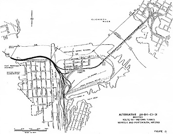 |
Here's a map scan from the Final Environmental Impact Statement,
EIS Number FHWA-VA-EIS-89-03-F, Route 58 / Midtown Tunnel (Including Pinners
Point Interchange), approved by FHWA, 11-8-1996.
This shows the approved alternative. The final design of the
Port Norfolk Connector bridge was identical to what is shown here, and the
final design of the Pinners Point Interchange is nearly identical to what
is shown here. The Parallel Midtown Tunnel would be built about 150 feet north
of the existing tunnel.
|
| Click for larger map images:
Medium (257 K),
Large (667 K). |
Pinners
Point Interchange (Port Norfolk Connector)
The Pinners Point Interchange (Port Norfolk Connector) in Portsmouth, Virginia,
has been completed, with all roadways fully opened by September, 2005, and the prime contractor
was
Tidewater Skanska,
Inc. This project is the 1.5-mile-long extension of the VA-164 Western Freeway
to the southerly Midtown Tunnel approach highway (Martin Luther King Freeway),
including a new 3-level directional interchange (the Pinners Point Interchange)
with the MLK Freeway, and the project includes reconstructing the MLK Freeway
between London Boulevard and the Midtown Tunnel, including a full local interchange
with all three legs of the highway complex at the east edge of Port Norfolk.
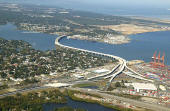 |
Completed Pinners Point Interchange (Port Norfolk Connector), looking
northwest across the Port Norfolk section of the City of Portsmouth,
across the Elizabeth River Western Branch, toward the West Norfolk section
of the City of Portsmouth. The James River is in the upper part of the
photo. The US-58 Martin Luther Freeway is to the lower left, the US-58
Midtown Tunnel approach highway is to the lower right, and the Portsmouth
Marine Terminal is to the lower right. The VA-164 Western Freeway crosses
the river and heads west to Churchland. The Pinners Point
Interchange is in the lower right, and it connects US-58 to VA-164.
Photo by VDOT, November 2005. Click image for large image (size 294
kilobytes). |
Various names have been used for this project, including "Western Freeway Extension",
"Port Norfolk Connector", "Pinners Point Connector" and "Pinners Point Interchange".
The name "Pinners Point Interchange" seems to be the name commonly used by VDOT
and the news media, during the period when the project has been under construction.
The name used on the title sheet of the project's final design plans, is "Pinners
Point Interchange". The name used for the project in the VDOT Six-Year Program
is "Pinners Point Interchange (Port Norfolk Connector)", and that is the name
that I tend to consider to be the most official and the most correct, since the
project contains two main components, the three-leg directional interchange and
the elevated freeway connector to the Western Freeway. Pinners Point is the name
of the peninsula-like land feature that projects out into the Elizabeth River,
generally the land area with the Portsmouth Marine Terminal and the area just
south of PMT.
"Construction
Will Begin on Long-Awaited Pinners Point Interchange",
VDOT news release, November 15, 2001, (excerpts in blue text):
The Commonwealth Transportation
Board at its monthly meeting today gave the green light for construction to begin
on the Pinners Point Interchange in Portsmouth. The interchange will provide a
more direct route to major ports with access to I-664 and the Monitor-Merrimac
Memorial Bridge-Tunnel as well as U.S. Route 17 via the Route 164 Western Freeway.
The $136.1 million contract award is the largest single contract ever awarded
by the Commonwealth Transportation Board. It was awarded to Tidewater Skanska,
Inc. of Norfolk. Under a relatively new bidding practice, the Virginia Department
of Transportation sought bids based, not only on project cost, but time it would
take to complete the project.
Tidewater Skanska bid the project to be completed in 14 months less than VDOT
had projected, " said Acting Chief Engineer Frank Gee. "The bid also provides
for an incentive of $20,000 a day up to 300 days for early completion and a penalty
of $20,000 a day for each day the project goes beyond the contract specifications."
Gee said VDOT is moving more towards these contractual arrangements in bidding
out certain projects to get them built quicker. The contractual practice was used
on some phases of the Springfield Interchange in Northern Virginia.
The Pinners Point Interchange project will result in a safer, less congested
pathway through the Port Norfolk area, which includes the Portsmouth Marine Terminal
and the Virginia Port Authority. When complete, the project links the Western
Freeway corridor to U.S. 58 and the Midtown Tunnel connecting Norfolk and Portsmouth.
The news release went on to say that the 1.54-mile-long project begins near
the east end of the West Norfolk Bridge and proceeds east with a bridge over the
Western Branch of the Elizabeth River to a point just north of Bayview Boulevard.
The highway continues southeasterly across property owned by TARMAC, Inc. and
the Portsmouth Marine Terminal, connecting with Route 58 (Martin Luther King Freeway)
and the Midtown Tunnel.
The new bridge over the Western Branch of the Elizabeth River, is not a cross-river
bridge, but is an offshore avoidance alignment where the bridge goes out offshore
to bypass the Port Norfolk neighborhood and then the bridge later returns to the
same shoreline. The news release goes on to say that this 3,500-foot-long bridge
will have a 6-lane divided roadway and will connect the West Norfolk Bridge to
the Pinners Point Interchange. All main roads in the Pinners Point Interchange
(Port Norfolk Connector) project will be designed as divided highways with two
lanes of traffic in each direction, separated by a median. The news release said
that construction of this project would begin in early 2002.
The eastern 1,200 feet of the 3,630-foot-long West Norfolk Bridge will be reconstructed
and realigned slightly northward so that it will make a seamless freeway connection
with the new Port Norfolk Connector bridge.
The completed VA-164 Western Freeway will no longer provide highway access
between the West Norfolk Bridge and the Port Norfolk neighborhood. The new Pinners
Point Interchange will provide full local access to all three legs of the freeway
complex, just east of the Port Norfolk neighborhood. It was the main consensus
among the citizens in the Port Norfolk neighborhood, to restrict access so as
to eliminate the through traffic, which comprises about 80% of the traffic that
currently passes through the neighborhood.
The offshore freeway viaduct seems like it would be a viewshed problem, since
the viaduct will be in the viewshed of a person looking across the shoreline out
into the Elizabeth River. I've looked at the mostly-completed viaduct in April
2004, and most of the view still exists between the bridge piers and the bridge
superstructure, and the freeway roadway is 33 feet above river mean high water
level. The view out into the river is mainly that of an industrial harbor. News
reports have indicated that the main consensus among the citizens in the Port
Norfolk neighborhood, is that the benefits of the offshore freeway (elimination
of most of the traffic in the neighborhood, reduced noise, increased property
values, with the highway being physically outside of the neighborhood) far outweighs
the negative impact of the reduced viewshed across the north shoreline of the
river; and that overall this is a very beneficial project for Port Norfolk.
"Pinners Point Interchange a Go at Midtown Tunnel", by the Virginian-Pilot,
November 16, 2001. Excerpts follow (blue text):
A stroke of a pen Thursday
assured residents of Portsmouth's Port Norfolk that relief is on the way from
years of foundation rattling, nerve-wracking, bumper-to-bumper traffic through
their community. A state highway panel awarded a contract to build the long-awaited
Pinners Point interchange. In addition to restoring tranquility to a historic
neighborhood, the new highway will save commuters valuable time -- time now spent
winding through narrow neighborhood streets on the way to and from the Midtown
Tunnel.
Construction will begin early next year, but the 1.5-mile project won't bring
relief until late 2004 when it's finished. Since the Western Freeway and Interstate
664 opened in 1992, tens of thousands of cars and trucks a day have poured into
the neighborhood.
Moving that traffic to what's known as the Pinners Point Connector has been
in the works for many years. But the project got delayed by budget shortfalls,
a debate over tolls, right of way issues and environmental reviews. It was even
included in a failed private proposal to build the interchange as well as a second
Midtown Tunnel. The road will help ease traffic in the neighborhood, improve access
for industrial truck traffic and connect the growing suburban areas of Churchland,
Western Branch and Suffolk to Norfolk and downtown Portsmouth.
The Virginian Pilot article went on to say that the $136 million
contract awarded to Tidewater Skanska Inc. of Norfolk, was the largest construction
contract ever awarded by VDOT (it was later superceded in dollar amount by one
of the US-1 Interchange contracts on the Woodrow Wilson Bridge Project). It also
said that the project was originally designed as a toll road, but that a financial
agreement was worked out whereby the City of Portsmouth will contribute $74 million
over the next 16 years, so that tolls will not need to be used. The road will
provide a direct connection from the Western Freeway to the Midtown Tunnel and
Martin Luther King Freeway. The highway will cross over the Elizabeth River, the
Portsmouth Marine Terminal, the concrete company Tarmac America Inc., an abandoned
wastewater treatment plant and railroad tracks.
State budget shortfalls threatened the contract that was awarded in
November 2001, but the funding was confirmed, and construction began in April
2002. The original specified completion date for the contract was December 20,
2005, but the contractor determined a plan to have the contract completed a
whole year earlier, on December 29, 2004.
"Contract
is Signed On Pinner's Point Interchange in Portsmouth",
VDOT news release, March 7, 2002, (excerpts in blue text):
The Virginia Department of
Transportation (VDOT) signed a contract today to begin construction on the Pinner's
Point Interchange in Portsmouth. The Commonwealth Transportation Board (CTB) awarded
the $136 million contract to Tidewater Skanska, Inc. of Norfolk last November.
VDOT put the project on hold due to revenue shortfalls as a result of the declining
economy. "VDOT has worked extremely hard to get this critical project back on
track," said VDOT Commissioner Ray D. Pethtel. "Because of project management
controls that VDOT has already made, we now have the cash flow to get started
with this very large construction project." "I am very pleased with the signing
of the Pinner's Point Interchange contract," said Governor Mark R. Warner.
Construction on the project will begin in early April and is slated for completion
in late 2004. While the CTB awarded the contract for $136 million, a total of
$162 million is budgeted for construction costs. As the project nears completion,
VDOT plans to install a traffic management system including traffic cameras and
other safety devices that will be controlled by the Smart Traffic Center in Hampton
Roads.
The VDOT website has this website link
about the project:
Pinners Point
Interchange
Pinners Point Interchange project purpose (quote from VDOT website in blue
text):
The project serves three major purposes.
It removes traffic from the historic Port Norfolk neighborhood, provides a more
direct route for industrial traffic to and from the terminal, and ensures faster,
easier access to the Midtown Tunnel for commuters. When the project is complete,
Port Norfolk residents will see a reduction in traffic by more than 80 percent.
Access to the Portsmouth Marine Terminal also will be smoother, and travel to
the Midtown Tunnel will be quicker.
"Pinners Point Road Project Offers Big Payoffs for Many", by
The Virginian-Pilot, January 30,
2004. Excerpts (in blue text):
The Pinners Point Interchange
now rising over the Portsmouth Marine Terminal may deliver what few road projects
ever promise anymore: an improved way of life for nearly everyone it will touch.
Marine-terminal truckers can expect faster and safer access to the Western Freeway.
Commuters from new neighborhoods in northern Suffolk and Chesapeake’s Western
Branch will find trips to the Midtown Tunnel easier, even though the two-lane
tunnel itself is not being widened. The Virginia Department of Transportation
may bask in the glory of achieving a goal that has recently proved difficult:
completion of a highway job on time and mostly on budget. For residents of Port
Norfolk, just west of the marine terminal, the project may offer the greatest
payoff of all: a return to the peace and quiet that defined life along this stretch
of the Elizabeth River a few decades ago.
For that reason alone, Civic League member Richard Ivy wants a catered party to
celebrate the interchange’s first important milestone: the planned April opening
of a bridge linking the Western Freeway to the Midtown Tunnel.
An estimated 28,000 tractor-trailers and other vehicles rumble daily past the
century-old Victorian homes on Bayview Boulevard and Chautauqua Avenue, two of
Port Norfolk’s busiest streets. An estimated 22,000 of those would be taken off
those streets when the more direct link between the freeway and the tunnel opens.
Other avenues in the neighborhood of more than 700 homes will get a break, too,
because motorists won’t shortcut along them anymore to sneak around traffic congestion.
“The situation at Bayview … has been the city’s primary traffic debacle since
the Western Freeway was completed across Churchland in the early ’90s,” said Richard
A. Hartman, the city’s chief engineer. “What you basically have is an interstate
ending in a local street.” Portsmouth placed such a high priority on the project,
which was first talked about nearly 30 years ago, that it committed $55 million
of federal grant money to it. That’s far more than the normal city share for such
a project and helped keep the interchange toll-free.
The original contract anticipated Pinners Point to cost $136.1 million, including
the Portsmouth share. Work began in the spring of 2002. The project, currently
VDOT’s biggest in South Hampton Roads, is scheduled to be completed in December.
For VDOT and Tidewater Skanska, the prime contractor, the job has not been without
surprises.
Almost immediately, workers found underground utilities that were not on any plans.
That forced some unexpected and costly relocations. Another complication came
when port officials requested that a planned lot for storing shipping containers
be enlarged to compensate for land taken from the marine terminal.
Construction was slowed in 2003 by the second-largest number of local rain days
in 55 years; the loss of a crane, which fell into the water and had to be retrieved;
and the disruption of deliveries to the job site after Hurricane Isabel flooded
the Midtown Tunnel in September.
The complications have pushed the project cost to $145.7 million, but that is
still within the 10 percent variance that planners of many big highway contracts
use to deal with unexpected problems, said P. Denis Gribok, VDOT’s resident engineer.
Buddy Watson, project director for Skanska, swells with pride when he talks about
the work that has gone into Pinners Point, about the 270 shafts drilled 100 feet
into the earth to support various fly-overs, or the elaborate orchestrating of
man and machine that is the routine of freeway construction. “It’s a big project,”
he said. “No bones about it.”
For VDOT officials, however, Pinners Point has been a source of pride. Transportation
Commissioner Philip A. Shucet credited a VDOT team – including Michael J. Johnson,
the engineering manager, and Gribok – and Skanska for keeping the work on schedule.
“The project got off to a rocky start when they ran into a bunch of stuff underground,”
Shucet said. “Rather than come to the table and ask us to pay them to extend the
deadline, the contractor came to the table with ideas about how to be on time.”
In 1998, city records indicate that 26 homes were sold in Port Norfolk for an
average price of $72,393. Last year, 61 homes changed hands for an average sale
price of $112,616, and some homes are now fetching more than $220,000. Some of
the increase can be attributed to an overall rise in home values, but Daniel said,
“most of it was because the people knew that Pinners Point was coming through.”
The VDOT Dashboard entry on
September 25, 2005, for project
Rte 164 Pinners Point Interchange (Port Norfolk Connector),
state project 0164-124-F04,PE101,RW101,C501,B638,B639,B640,B641,B642,B643,
had the following data points:
Construction Company - Tidewater
Skanska, Inc.
Contract Start Date - 3/15/2002
Contract Original Specified Completion Date - December 20, 2005
Contract Current Specified Completion Date - July 21, 2005
Estimated Completion Date - November 19, 2005
Contract Award Amount - $136,139,315
Cost of Work To Date - $146,404,381
Current Contract Amount - $150,922,326
Inspector's Estimated Amount to Complete - $136,139,315(???)
Current Specified Completion Date < Today
Project 10.8% Over Original Contract Award Amount
The VDOT Dashboard entry on
April 30, 2005, for project
Rte 164 Pinners Point Interchange (Port Norfolk Connector),
state project 0164-124-F04,PE101,RW101,C501,B638,B639,B640,B641,B642,B643,
had the following data points:
Construction Company - Tidewater
Skanska, Inc.
Contract Start Date - 3/15/2002
Contract Original Specified Completion Date - 12/20/2005
Contract Current Specified Completion Date - 12/29/2004
Estimated Completion Date - 7/19/2005
Contract Award Amount - $136,139,315
Cost of Work To Date - $133,728,395
Current Contract Amount - $144,991,939
Inspector's Estimated Amount to Complete - $153,124,609
Current Specified Completion Date < Today
Project 12.4% Over Original Contract Award Amount
The VDOT Dashboard entry on
February 28, 2005, for project
Rte 164 Pinners Point Interchange (Port Norfolk Connector),
had the following data points:
Construction Company - Tidewater
Skanska, Inc.
Contract Start Date - 3/15/2002
Contract Original Specified Completion Date - 12/20/2005
Contract Current Specified Completion Date - 12/29/2004
Estimated Completion Date - 6/1/2005
% Critical Work Completed - 98.6%
Contract Award Amount - $136,139,315
Cost of Work To Date - $126,886,693
Current Contract Amount - $144,554,143
Inspector's Estimated Amount to Complete - $153,124,609
Current Specified Completion Date < Today
Project 12.4% Over Original Contract Award Amount
The VDOT Dashboard entry on October
27, 2004, for project
Rte 164 Pinners Point Interchange (Port Norfolk Connector),
had the following data points:
Construction Company - Tidewater
Skanska, Inc.
Contract Start Date - 3/15/2002
Contract Original Specified Completion Date - 12/20/2005
Contract Current Specified Completion Date - 12/29/2004
Estimated Completion Date - 6/1/2005
% Critical Work Completed - 88.6%
Contract Award Amount - $136,139,315
Cost of Work To Date - $120,284,506
Current Contract Amount - $144,431,628
Inspector's Estimated Amount to Complete - $153,124,609
Project <1% Behind Schedule
Project 12.4% Over Original Contract Award Amount
The VDOT Dashboard entry on May 26, 2004, for
project
Rte 164 Pinners Point Interchange (Port Norfolk Connector),
had the following data points:
Construction Company - Tidewater
Skanska, Inc.
Contract Start Date - 3/15/2002
Contract Original Specified Completion Date - 12/20/2005
Contract Current Specified Completion Date - 12/29/2004
Estimated Completion Date - 12/29/2004
% Critical Work Completed - 76.3%
Contract Award Amount - $136,139,315
Cost of Work To Date - $103,998,809
Current Contract Amount - $144,133,291
Inspector's Estimated Amount to Complete - $145,731,644
Project <1% Behind Schedule
Project 7.0% Over Original Contract Award Amount
The VDOT Six-Year Program FY2005-2010, entry for the Pinner's Point Interchange
(Port Norfolk Connector) project, listed these budgeted costs (in dollars):
Preliminary
Engineering ..... 18,383,000
Right-of-Way ................ 7,649,000
Construction ................ 161,166,000
Total Cost .................. 187,198,000
 |
Pinners
Point Interchange construction at left edge of photo, with Port Norfolk neighborhood
in center part of photo, with new Port Norfolk Connector freeway bridge under
construction in center of photo, with south end of the West Norfolk Bridge
in right side of photo. Looking south. Photo by VDOT, February 2004. Click
image for large image (size 424 kilobytes). |
Pinners Point Interchange (Port Norfolk Connector)
Openings
The first segment of the project opened to traffic on Sunday, September 19,
2004. The VA-164 West Norfolk Bridge extension opened, and new ramps opened, including
the two ramps between the Midtown Tunnel and the West Norfolk Bridge, and a local
ramp connecting the Port Norfolk area to the West Norfolk Bridge. The VA-164 West
Norfolk Bridge passes over the Elizabeth River Western Branch, and the Port Norfolk
Connector portion opened on its first 2-lane 2-way roadway.
"VDOT
To Open Much Anticipated Portion of Western Freeway at Pinners Point this Weekend",
VDOT news release,
September 17, 2004, (excerpts in blue text):
Overcoming a week
of heavy rainfall, VDOT crews will shift traffic onto a new portion of the Western
Freeway on Sunday, Sept. 19, and provide motorists with direct access to and from
the Midtown Tunnel on I-164. The shift will also remove traffic from the Port
Norfolk neighborhood. “This shift is a major milestone for the project. Not only
will it remove 80 percent of traffic from the Port Norfolk neighborhood, it will
also improve commuter access to and from the Midtown Tunnel and streamline industrial
access to the Portsmouth Marine Terminal,” says Norfolk Resident Engineer Denis
Gribok, P.E. “We’ve been looking forward to this traffic shift since the spring.
We’ve done a significant amount of traffic engineering and studies to assure that
this shift will go smoothly.”
Weather permitting, crews will finish shifting existing traffic from the West
Norfolk Bridge onto the newly constructed eastbound lanes of the Western Freeway
on Sunday afternoon by 5 p.m. Traffic will continue to flow one lane in each direction
until the project is completed this spring. Variable message signs will alert
motorists to the new traffic pattern.
All ramp access to Bayview Boulevard from the Western Freeway will be permanently
closed following Sunday’s traffic shift. Industrial and local traffic coming from
the Western Freeway should use the Cleveland Street exit ramp (also known as Railroad
Avenue), to access the Portsmouth Marine Terminal and Port Norfolk Neighborhood.
Port Norfolk traffic wishing to access the Midtown Tunnel should continue to use
Cleveland Street.
"Pinners
Point Opening Eases Commute", by
The Virginian-Pilot, September
21, 2004. Excerpts (in blue text):
The partial opening of the Pinners Point interchange produced
a smooth morning commute Monday except for some minor problems that engineers
hope additional signs will correct. 'The opening allowed thousands of motorists
to travel directly to the Midtown Tunnel from the Western Freeway and avoid a
lengthy roundabout through Port Norfolk that had been the norm for years. Residents
of Port Norfolk welcomed the opening because it diverted thousands of trucks bound
for the Portsmouth Marine Terminal from their neighborhood.
'“We had a couple of kinks this morning, and we’re putting some additional signs
out that people recommended, but it was the first day of a new traffic pattern
and it was about everything we expected,” said Tiffany Elliott, a spokeswoman
for the Virginia Department of Transportation. She said the Portsmouth Police
Department suggested that signs be posted to remind drivers that slowing down
will help them make the transition to a new traffic pattern. The signs were added
Monday afternoon throughout the project site. “It went well,” said P. Denis Gribok
, VDOT’s resident engineer for Hampton Roads.
The biggest problem appeared at what engineers admit is an unusual feature
to the new interchange – a temporary stop sign in the middle of the West Norfolk
Bridge. It is needed to allow eastbound tunnel-bound traffic to cross in front
of westbound traffic coming up a ramp that leads from Port Norfolk and Cleveland
Street.
Opening the next phase in the project will happen in about 60 days when more lanes
are opened on U.S. 58. When that part is completed, commuters will take one bridge
to reach the Midtown and a separate, parallel bridge to reach the Western Freeway,
and the stop sign will be removed.
I drove through the project area on the following
Saturday, 6 days after it opened.
A section of the project was opened to traffic
on April 24, 2004, but had to be closed 5 days later, and the existing roads reconfigured
to their original configuration, because not enough of the project was complete
to avoid greater overall traffic congestion in the Port Norfolk area. This April
opening involved opening 2 lanes extending the VA-164 West Norfolk Bridge to Cleveland
Street at the east edge of the Port Norfolk neighborhood, and this freeway section
had 2-lane 2-way traffic.
The September 18, 2004 opening is working out
well trafficwise. Like the April 24th opening, this opening includes the first
2 lanes of the extension of the VA-164 Western Freeway to Cleveland Street, with
2-lane 2-way traffic, but it also includes the two ramp connections between the
Western Freeway and the Midtown Tunnel, and a better connection between the Midtown
Tunnel and the MLK Freeway which now uses a rebuilt bridge over Cleveland Street
that was not complete in April. All these movements are on one-lane roadways that
will have 2 or more lanes when the whole project is complete. There is a center
lane for left turns controlled by a temporary stop sign (replaced with a temporary
traffic signal two weeks later), for eastbound VA-164 traffic heading to the Midtown
Tunnel, where they turn across westbound VA-164 and utilize a temporary one-lane
ramp movement to access the Midtown Tunnel. There are temporary local ramp connections
between the Western Freeway and the Port Norfolk area and Portsmouth Marine Terminal
(PMT), and there are temporary local ramp connections between the Midtown Tunnel
and the Port Norfolk area and PMT.
With the opening of the VA-164 Western Freeway
extension, all ramp access to Bayview Boulevard in Port Norfolk is permanently
closed. The West Norfolk Bridge and Bayview Boulevard formerly made a seamless
connection as one continuous thoroughfare.
The eastern 1,200 feet of the 3,630-foot-long
4-lane West Norfolk Bridge is being reconstructed and realigned slightly northward
so that it will make a seamless freeway connection with the new offshore Port
Norfolk Connector bridge which extends the Western Freeway to the Midtown Tunnel
approach highway.
In the first phase of the project, the westbound
side of the West Norfolk Bridge was closed so that the eastern 1,200 feet of the
westbound side of the bridge could be demolished, and so that the westbound side
of the new Port Norfolk Connector bridge could be built and tied into the West
Norfolk Bridge; and 2-lane 2-way traffic was temporarily routed onto the eastbound
side of the West Norfolk Bridge.
In the second phase of the project that opened
to traffic on September 18th, 2-lane 2-way traffic is temporarily routed onto
the westbound side of the West Norfolk Bridge, with 2-lane 2-way traffic seamlessly
flowing to/from the westbound side of the new Port Norfolk Connector bridge (the
extension of the West Norfolk Bridge). Now the eastern 1,200 feet of the eastbound
side of the West Norfolk Bridge can be demolished, and the eastbound side of the
new Port Norfolk Connector bridge can be built and tied into the West Norfolk
Bridge, completing the seamless extension of the West Norfolk Bridge.
The local combined offramp for VA-164 eastbound
(from West Norfolk Bridge) and US-58 southbound (from Midtown Tunnel) is being
temporarily used for 2-lane 2-way VA-164 traffic. That ramp ends at a signalized
intersection with Cleveland Street. Segments of the over-water VA-164 Port Norfolk
Connector bridge opened also, about 1,000 feet of the westbound bridge and then
a crossover to the remainder of the eastbound bridge, and a 2-lane 2-way roadway
is open through this whole area between the existing West Norfolk Bridge and Cleveland
Street near the entrance to the Portsmouth Marine Terminal.
Bayview Boulevard and Chautauqua Avenue skirt
the perimeter of the Port Norfolk neighborhood in Portsmouth, and they connected
the VA-164 Western Freeway to the Midtown Tunnel and the Portsmouth Marine Terminal.
Mount Vernon Avenue runs north-south and passes through the center of the Port
Norfolk neighborhood, and connects to Bayview Boulevard a few blocks east of the
former end of the West Norfolk Bridge, so Mount Vernon Avenue served as a north-south
thoroughfare between central Portsmouth and the VA-164 Western Freeway. The Pinners
Point Interchange (Port Norfolk Connector) has replaced those through traffic
functions.
It was interesting to drive the first installment
of the Pinners Point Interchange Project, and it adds 1.5 miles to VA-164. The
prime contractor, Tidewater Skanska, Inc., plans to have the whole project completed
by June 1, 2005.
"New
Pinners Point Segment Opens to Traffic This Friday",
VDOT news release,
November 17, 2004, (excerpts in blue text):
One step closer to
completing the Pinners Point project, the Virginia Department of
Transportation (VDOT) will open a new bridge connecting the Midtown Tunnel to
the Western Freeway after rush hour this Friday between 10 a.m. and 11 a.m.
The new bridge is part of the permanent traffic pattern for motorists exiting
the Midtown Tunnel for the Western Freeway (Route 164).
Signage on Friday will direct motorists exiting the Midtown Tunnel to stay to
the right for Route 164 west. The new traffic pattern will then route
motorists onto the new bridge where they will eventually merge with Route 164
westbound traffic at the existing West Norfolk Bridge. Motorists traveling to
the London Boulevard/ High Street area should continue to remain to the left
as they exit the tunnel.
“As part of the permanent traffic pattern for the new Pinners Point
interchange, this switch will streamline access to the Western Freeway and
help to eliminate some of the confusion and congestion in the area,” said VDOT
Project Manager Mike Johnson.
The initial opening on this project on September 18, 2004
provided a direct connection between the VA-164 Western Freeway and the
Midtown Tunnel. It utilized temporary 2-lane 2-way traffic on what will be the
permanent 2-lane directional ramp from the Western Freeway to the Midtown
Tunnel approach highway. The above
November 17, 2004 opening involved opening one lane on the permanent
2-lane directional ramp from the Midtown Tunnel approach highway, to the
Western Freeway, and opening one lane on the westbound new Port Norfolk
Connector bridge to carry this one lane ramp movement to the westbound VA-164
Western Freeway. The permanent 2-lane directional ramp from the Western
Freeway to the Midtown Tunnel approach highway, now carries one lane of
traffic to the Midtown Tunnel, with the new movement above having eliminated
the temporary opposite direction one lane of traffic.
Pinners Point Interchange (Port Norfolk Connector) Fully Open
On a September 10, 2005 trip to Portsmouth,
I was pleasantly surprised to see that the entire Pinners Point Interchange,
MLK Freeway, West Norfolk bridge extension, and all ramps, are open to
traffic, except for two places where 3-lane roadways have 2 lanes open and one
lane closed by barrels.
The eastern 1,200 feet of the 3,630-foot-long West Norfolk Bridge has been
reconstructed and realigned slightly northward so that it makes a seamless
freeway connection with the new 3,500-foot-long Port Norfolk Connector bridge,
so the extended West Norfolk Bridge is now 5,930 feet long. Effectively the
whole project is open to traffic, although about 5 overhead sign structures
still need to be constructed, so there are barrels and construction activities
still on the project. Those sign structures are massive, so it may take
another month to construct them. There are three overhead sign structures that
have been erected. Both sides of the West Norfolk Bridge and its extension
(the Port Norfolk Connector) are open to 2 lanes each way. The two Pinners
Point Interchange directional ramps to the Midtown Tunnel approach highway,
are each two lanes wide but have permanent line painting for one lane, since
all that merges into one northbound lane through the tunnel; and those second
lanes on those ramps will remain closed until the parallel Midtown Tunnel is
built in the future. The four other Pinners Point Interchange directional
ramps are opened to their 2-lane configuration. All 6 of the local ramps are
open to traffic, 2 for each of the 3 legs of the freeway complex connected by
the Pinners Point Interchange.
It was enjoyable to drive through, and I took 60 digital photos which are posted on my
September 2005 photo article.
The July 27, 2005 Virginian-Pilot article below, seems to indicate that
these openings took place between July 29 and August 6.
Work on Bayview Boulevard, formerly the arterial connector to the former
east end of the West Norfolk Bridge, has been completed. This
waterfront road was reduced from 4 lanes to 2 lanes, repaved, and the
roadsides nicely landscaped and a pedestrian/bicycle trail built
alongside the road, and the pedestrian/bicycle trail has a bridge to the
West Norfolk Bridge so that pedestrians and bicyclists can utilize the
north shoulder of the bridge to cross the river. Bayview Boulevard is
now a quiet residential street with neighborhood traffic only.
Now we have a completed freeway (VA-164 and US-58) between Churchland
and downtown Norfolk, with the only less-than-4-lane section being the
Midtown Tunnel; and a completed freeway (I-664, VA-164 and US-58)
between Newport News and downtown Norfolk. The MLK Freeway comes within
a mile of downtown Portsmouth, and the VA-141 London Boulevard 4-lane arterial connects
the MLK Freeway to downtown Portsmouth, so effectively downtown
Portsmouth is also connected to the VA-164 Western Freeway and to
Newport News and the Peninsula.
"More
changes are coming at Pinners Point interchange",
Virginian-Pilot, July 27,
2005. Excerpts (in blue text):
Commuters traveling through the
Pinners Point interchange will encounter significant changes in traffic
patterns on the West Norfolk Bridge starting Friday. The switch will precede a
larger change scheduled for Aug. 6, when new ramps are to be opened to ease
traffic around the Portsmouth Marine Terminal. The changes are some of the
finishing touches in the project as it moves toward a fall completion.
Currently, all traffic on the bridge – one eastbound lane, one westbound lane
– moves across one side of the span. On Friday, however, the eastbound lane
will be transferred to the bridge’s newly constructed other side. By fall, a
second lane will be opened in each direction. But first, workers need to
install overhead signs and apply permanent lane markings.
The changes in early August are more complicated but promise to help
motorists realize the full scope of Pinners Point, a collection of
bridges and ramps intended to ease port-bound truck traffic around local
neighborhoods and provide simpler access to the Western Freeway. Weather permitting, engineers from the Virginia Department of
Transportation will open a more direct link to the Western Freeway for motorists on U.S. 58. At the same time, they plan to open a new ramp at Cleveland Street for
motorists heading from Port Norfolk to the freeway. Those drivers will now
pass under a railroad overpass on their way to the ramp. With the latter change, workers will remove the temporary traffic
signals that are now in place at the top of the exit to Cleveland
Street, said K.W. Rawls, senior construction inspector for VDOT.
Photo Articles of the Pinners
Point Interchange Project
These articles are by Roads to the
Future
Pinners
Point Interchange Construction Photos - February 2004 - 32 aerial photos
Pinners Point Interchange Construction
Photos - March & May 2004 - 5 photos
Pinners Point Interchange Construction
Photos - September 2004 - 8 photos
Pinners Point Interchange Construction
Photos - October 2004 - 22 photos
Pinners
Point Interchange Construction Photos - December 2004 - 57 aerial photos
Pinners
Point Interchange Construction Photos - April 2005 - 13 photos
Pinners
Point Interchange Construction Photos - September 2005 - 60 photos
 |
Completed Pinners Point Interchange (Port Norfolk Connector), looking
northwest across the Port Norfolk section of the City of Portsmouth,
across the Elizabeth River Western Branch, toward the West Norfolk section
of the City of Portsmouth. The James River is in the upper part of the
photo. The US-58 Martin Luther Freeway is to the lower left, the US-58
Midtown Tunnel approach highway is to the lower right, and the Portsmouth
Marine Terminal is to the lower right. The VA-164 Western Freeway crosses
the river and heads west to Churchland. The Pinners Point
Interchange is in the lower right, and it connects US-58 to VA-164.
Photo by VDOT, November 2005. Click image for large image (size 294
kilobytes). |
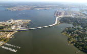 |
Completed
Pinners Point Interchange (Port Norfolk Connector), looking east across the
West Norfolk section of the City of Portsmouth to the left, across the Elizabeth River
Western Branch, toward the Port Norfolk section of the City of Portsmouth
to the right.
Downtown Norfolk is across the Elizabeth River in the upper part of the
photo. The US-58 Martin Luther Freeway is to the upper right, the US-58
Midtown Tunnel approach highway is to the upper right, and the Portsmouth
Marine Terminal is to the upper right. The VA-164 Western Freeway crosses
the river. The Pinners Point Interchange is in the upper right, and it connects US-58 to
VA-164. Photo by VDOT, November 2005. Click
image for large image (size 202 kilobytes). |
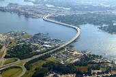 |
Completed
Pinners Point Interchange (Port Norfolk Connector), looking southeast across
the West Norfolk section of the City of Portsmouth, across the Elizabeth
River Western Branch, toward the Port Norfolk section of the City of
Portsmouth. The US-58 Martin Luther Freeway is to the upper right, the
US-58 Midtown Tunnel approach highway is to the upper left, and the
Portsmouth Marine Terminal is to the upper left. The VA-164 Western
Freeway crosses the river. The Pinners Point Interchange is in the upper center, and it connects US-58 to
VA-164. Photo by VDOT,
November 2005. Click
image for large image (size 258 kilobytes). |
Parallel Midtown Tunnel and Martin Luther King
Freeway Extension
There were transportation tax referendums in Virginia in November 2002; there
was a referendum in Northern Virginia and a referendum in the Norfolk/Hampton
Roads area. Both referenda were voted down at the polls. The referendum in the
Norfolk/Hampton Roads area would have authorized a 1 cent increase in the region's
sales tax, and would have authorized $7 billion in new transportation funding
over a 20-year period, including paying for the entire cost of the Parallel Midtown
Tunnel and Martin Luther King Freeway Extension.
Neither of these projects are programmed in the VDOT Six Year Program for Fiscal
Year 2005-2010, which is the current Six Year Program as of this writing in June
2004.
On November 1, 2004, VDOT advertised a Request for Information (RFI) for
the Midtown Tunnel Corridor Project (MTCP). This would include the Parallel Midtown
Tunnel and its approaches to provide an upgraded 4-lane tunnel complex connecting the
new Pinners Point Interchange in Portsmouth to Brambleton Avenue and Hampton Boulevard
in downtown Norfolk. Three RFIs were received by VDOT by the deadline of January
18, 2005.
The Midtown Tunnel Corridor
Project (MTCP) is on the
VDOT Request for Information (RFI) webpage on
VDOT's website.
Excerpt (in blue text):
The Virginia Department of Transportation (VDOT) is seeking
Statements of Interest (SOI) from private entities (respondents) that are qualified
and experienced with design, construction, improvement, maintenance, and/or operation
of limited-access highway facilities and tunnels. VDOT will consider responses
to this Request for Information (RFI), and determine whether to solicit conceptual
proposals under the Public-Private Transportation Act of 1995, as amended (the PPTA), for constructing all or part(s) of expansion of the Midtown Tunnel Corridor
(Route 58 under the Elizabeth River and approach roadways) in the Cities of Norfolk
and Portsmouth in Virginia. VDOT is considering future procurement with competitive
negotiation procedures under the PPTA because of the potential for risk sharing,
non-public funding, and other economic benefits which would not otherwise be available
through a competitive bidding process.
Like the quote says, VDOT wanted to gauge what interest may exist in the
private sector to form a public-private partnership with VDOT to fund and
build this project, along with an outline of what the private entity would
propose, so that if enough interest was shown as a result of this RFI, VDOT
may decide to solicit conceptual proposals under the provisions of Virginia's
Public-Private
Transportation Act (PPTA), to build this project. VDOT received three
Statements of Interest (SOI) for the MTCP, from Tidewater Skanska, Inc., from
Jacobs Civil, Inc., and from the Parsons Transportation Group. The links to
each SOI are on the VDOT RFI webpage linked above. The SOI submitted by
Tidewater Skanska, Inc. emphasized the importance of including the MLK Freeway
Extension in this project, as it was not in the RFI for the MTCP; and this
proposer also emphasized the need to get FHWA final approval for the
re-tolling of the Downtown Tunnel, so that the tolls on both tunnels could
support the bond financing of the MTCP project. The next step for this
project, would be for VDOT to solicit conceptual proposals under the PPTA.
Martin Luther King Freeway
Extension
In 1989, VDOT engineering studies identified 5 build alternates for the Martin
Luther King Freeway Extension, and completed a Final Environmental Assessment
in May 1990, which detailed the alternatives. This document did not receive final
FHWA approval, because of later modifications to the project, and VDOT prepared
a new Final Environmental Assessment, which was completed by VDOT in March 1999.
Since the project did not have a funding source for construction, FHWA did not
issue a Finding of No Significant Impact (FONSI) on the Environmental Assessment,
nor did FHWA request a full Environmental Impact Statement (EIS) for the project.
VDOT's studies did determine a preferred alternative for this project, and this
preferred alternative was selected by the City of Portsmouth, and approved by
the Commonwealth Transportation Board, in 1990.
Final Environmental Assessment
Martin Luther King Jr. Freeway Extension Study
City of Portsmouth
State Project: 0058-124-F04,PE101,RW201,C501
Federal Project: M-5403( )
U.S. Department of Transportation, Federal Highway Administration
Prepared by Virginia Department of Transportation
Submitted Pursuant to 42 U.S.C. 4332, March 1999
The cost estimates for this project
are about $100 million for design, right-of-way and construction. This Final Environmental
Assessment shows the most recent detailed plan for the project, so I use it as
a prime source in this article, with quotes below.
Quotes from Final Environmental Assessment of March 1999 ---
1.1 PROJECT DESCRIPTION (Quote in blue text):
VDOT and FHWA propose to extend
the MLK Freeway from Interstate 264 (I-264) to London Boulevard in the City of
Portsmouth, Virginia. Designated as US Route 58 and Virginia Alternate 337, the
freeway is a north-south, four-lane facility that provides access to the City
of Norfolk via the Midtown Tunnel. I-264, via the Downtown Tunnel, is the only
other direct highway link between Portsmouth and Norfolk. Both of the tunnels
are important parts of the regional highway network, as congestion levels indicate.
The project would involve highway construction on new location for approximately
1.13 kilometers (0.70 miles) and improvements to I-264 for a distance of 1.52
kilometers (0.95 miles). An elevated, limited access facility has been selected
as the preferred alternative for the project.
The project area is located in southeastern Virginia, in a very urbanized area
within the City of Portsmouth, approximately 3.05 kilometers (1.89 miles) south
of the confluence of the Western and Southern Branches of the Elizabeth River.
The project area consists of varied land uses, including heavy and light industrial,
urban low and medium density residential, public/institutional facilities, and
commercial.
1.2 PROJECT STATUS (Quote in blue text):
In 1989, engineering studies
identified five build alternatives for the project: Alternatives A-E. Based on
these studies, VDOT (with FHWA concurrence) eliminated Alternatives C and D from
further consideration. The following year, VDOT prepared and submitted a preliminary
Draft Environmental Assessment (EA) to FHWA that identified Alternative E as the
preferred alternative. On September 10, 1990, the Portsmouth City Council approved
a resolution citing Alternative E as its preferred alternative. On October 24,
1990, the Commonwealth Transportation Board approved the location of Alternative
E. For these reasons, this document does not present detailed information on alternatives
other than this selected alternative.
In 1992, VDOT completed and submitted a preliminary Final EA and a Final EA. However,
FHWA did not prepare a Finding of No Significant Impact (FONSI). Since then, the
project design has changed to include features such as a collector-distributor
road on eastbound I-264 and a new alignment for Columbus Street. Local and regional
planning documents reference and support the project. For example, the General
Land Use map contained in the City of Portsmouth's comprehensive plan shows MLK
Freeway extended to I-264. The project is also a component of the Southeastern
Virginia Regional Concept plan. Both the Virginia Chamber of Commerce and the
Portsmouth Chamber of Commerce support the MLK Freeway Extension.
1.3.1 System Linkage (Quote in blue text):
In the Tidewater area, I-264
and Route 58 link the area's ports and other facilities to outside markets. These
highways serve as part of the regional highway network and, as such, are important
commercial and commuter routes. I-264 extends west to the convergence of I-664
and I-64 in the City of Chesapeake. Further to the east, it crosses the Southern
Branch of the Elizabeth River before connecting with I-464. It then extends through
the City of Norfolk before its terminus at the I-64 interchange.
The MLK Freeway becomes Hampton Boulevard (Route 337) and Brambleton Avenue (Route
58) upon entering the City of Norfolk. Hampton Boulevard extends north to the
Norfolk Naval Air Station, the Norfolk International Terminals, and the Sewells
Point Terminals. These facilities serve as major employment and shipping centers
and, therefore, generate considerable traffic.
In the City of Portsmouth, a direct, limited access connection does not currently
exist between the MLK Freeway and I-264, forcing drivers to use circuitous routes
via local city streets. The proposed project would address this problem by providing
a limited-access facility for through traffic, thereby reducing congestion on
local streets. It would also supplement the Pinners Point Interchange project,
located immediately to the north. Moreover, the project would relieve some of
the traffic impacts to the Port Norfolk Historic District, located west of the
MLK Freeway.
The MLK Freeway Extension would also provide for other key movements in the area.
For example, it would serve as an alternative to the Downtown Tunnel for traffic
to Norfolk from points to the west and south. It would also provide an alternative
route for I-264 traffic when the Downtown Tunnel is congested or closed.
The MLK Freeway Extension would complement other nearby highway projects. The
Pinners Point Interchange Project is a project that involves highway construction
and improvements directly to the north of the MLK project. The Pinners Point project
would provide an east-west link between the Western Freeway and Route 58. The
project consists of construction of the Pinners Point Interchange and a limited-access
highway connector to the Western Freeway in Portsmouth. Advertisement of the Pinners
Point Interchange and Connector will likely begin in 2000.
3. IMPACTS (Quote in blue text):
This section addresses social,
economic, and environmental impacts of the preferred Alternative E. In 1990, VDOT
prepared and submitted a preliminary Draft Environmental Assessment (EA) to FHWA
that identified Alternative E as the preferred alternative. On September 10, 1990,
the Portsmouth City Council approved a resolution citing Alternative E as its
preferred alternative. On October 24, 1990, the Commonwealth Transportation Board
approved the location of Alternative E. Since it has been established as the preferred
alternative, this chapter only discusses impacts associated with Alternative E.
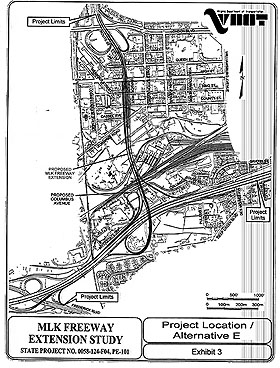 |
This exhibit is from the Final Environmental Assessment, Martin Luther
King Jr. Freeway Extension Study, City of Portsmouth, prepared by Virginia
Department of Transportation, March 1999.
On the page, the existing interchange between the MLK Freeway and London
Boulevard is at the top of the page, I-264 runs left-right across the lower
part of the page, and the MLK Freeway Extension and interchange with I-264
is in the middle of the page.
Click for larger images:
Medium (160 kilobytes),
Large (497 kilobytes),
Extra Large (1,358 kilobytes).
|
2007 Opinion on Funding of
Parallel Midtown Tunnel and MLK Freeway Extension
Roads to the Future opined in 2007:
The need has existed for a long time, to build the projects for the
Parallel Midtown Tunnel and the Martin Luther King Freeway Extension, and most
officials and businesspersons in the Hampton Roads area believe the same. After
the expansion projects on I-264 between downtown Portsmouth and downtown Norfolk
were completed in 1991, which included the parallel Downtown Tunnel and the parallel
Berkley Bridge, the next logical project in the next 5-10 years, to increase highway
capacity across the Elizabeth River between Norfolk and Portsmouth, was the construction
of the three projects that are in the title of this article, the VA-164/MLK/Midtown
Tunnel extension/expansion.
There have been two main eras of construction of bridges and tunnels across
the Elizabeth River and across the Hampton Roads estuary, the “toll financing
era” of 1950-1962 where these major highway facilities were financed with toll
revenue bond financing: first 2-lane Downtown Tunnel and first 4-lane Berkley
Bridge (opened 1952), first 2-lane Hampton Roads Bridge-Tunnel (opened 1957),
2-lane Midtown Tunnel (opened 1962); and the “Interstate highway funding era”
of 1972-1992 where these major highway facilities were financed with 90% federal
Interstate highway funding and 10% state funding: second 2-lane Hampton Roads
Bridge-Tunnel (I-64, opened 1976), second 2-lane Downtown Tunnel (I-264, opened
1987) and second 4-lane Berkley Bridge and upgraded approaches and interchanges
(I-264, completed 1991), and the 4-lane I-664 Monitor-Merrimac Bridge-Tunnel (opened
1992).
The “toll financing era” provided needed highway facilities before there was
the large funding mechanism of the road-user-tax-stocked U.S. Highway Trust Fund
(HTF), and the HTF provided the “Interstate highway funding era" whereby Interstate
highways were built without tolls. The Interstate highway system beginning in
1956 provided many expensive highways throughout the U.S., and without tolls.
The original Interstate highway system mileage (42,500 miles) was completed nationwide
in 1996, and the U.S. Highway Trust Fund still is in use, but its funding today
is spread over many different types of highway projects and systems, and a considerable
portion of the HTF is still dedicated to the original Interstate highway system,
parts of which were built 35 to 40 years or more ago, for the funding of expensive
widening and rehabilitation projects, a funding need which is not lessening. The
upshot of this is that from about 1990 onward, there has again been an upsurge
in toll revenue bond financing in the nation, since highway construction needs
in many places exceed the available state and federal highway tax funding mechanisms,
also since some highway projects are extremely expensive to build.
A
s written earlier in this article, the Norfolk/Hampton Roads region progressively eliminated
highway tolls because many local citizens and elected officials believed that
tolls were hindering commerce and placing an unfair burden on the users of those
facilities, and a couple economic studies were performed by the local metropolitan
planning organization in the 1970s, that demonstrated the significant economic
benefits that would accrue to the public by eliminating the tolls on the crossings
of the Elizabeth River and the Hampton Roads estuary. When the Interstate-funded
second 2-lane Hampton Roads Bridge-Tunnel opened in 1976, the whole facility became
the toll-free 4-lane I-64 with one 2-lane facility each way, and the US-17 James
River Bridge became toll-free at the same time. The bonds were paid off on the
Downtown Tunnel and Midtown Tunnel in 1986, and both facilities became toll-free
that year. As was said, the expansion of the Downtown Tunnel
(to 4 lanes, with two 2-lane tubes)
and the Berkley Bridge (to 8 lanes, with two 4-lane bridges)
was funded as a toll-free Interstate highway project, and the I-664 bridge-tunnel
crossing of Hampton Roads was a toll-free Interstate highway project from its
inception.
The $180 million Pinners Point Interchange project is complete,
and it provides an important segment of the VA-164/MLK/Midtown Tunnel extension/expansion
project. These highways were never added to the Interstate highway system, so
while they qualify for major amounts of federal funding, the funding ratio is
much lower than the 90% federal funding that was used to build the Interstate
highway system; so that makes it considerably more difficult for the state to
fund these projects, because of the much higher shares of state matching funds
needed. The cost estimates for the other projects, in 2004 dollars, are about
$350 million for the Parallel Midtown Tunnel and approaches, and about $100 million
for the MLK Freeway Extension. Either project alone would feasibly connect with
the Pinners Point Interchange project, and provide major benefits, and of course
the best option would be to build both.
The competed Pinners Point Interchange project should “stimulate peoples’ appetites”
as to the benefits of the expansion of this highway complex, and it will be seen
as a huge improvement by itself, as people experience its benefits. Hopefully
it will “increase peoples’ appetites” as to the need to fund and build the rest
of the complex. In any event, a huge portion of the complex will be complete.
It would be nice to see the Parallel Midtown Tunnel and MLK Freeway Extension
projects funded without tolls via state and federal highway funds, but the current
revenue streams don’t allow either project to be funded in the current VDOT Six
Year Program. Perhaps there will be increases in the state and/or federal fuel
taxes in the next year or two, allowing the projects to be funded, but these are
very expensive projects, and there are plenty of needed road construction projects
on other Hampton Roads regional highways and roads.
With traffic volumes of over 46,000 vehicles per day on the 2-lane Midtown
Tunnel and over 95,000 vehicles per day on the 4-lane Downtown Tunnel, and increased
traffic projected in the future, these tunnels are very overloaded with traffic,
with high congestion during peak hours. It won’t “solve” traffic congestion to
build the Parallel Midtown Tunnel and the MLK Freeway Extension, but it will certainly
help greatly in providing more capacity, plus the elimination of 2-lane 2-way
traffic in the confined space of the tunnel, via provision of a separate 2-lane
roadway tube for each direction of Midtown Tunnel traffic; there will be a more
balanced traffic load between the Midtown and Downtown tunnels, and if there is
a traffic incident that clogs the Downtown Tunnel, the 4-lane alternate MLK Freeway
route between I-264 in Portsmouth and downtown Norfolk will help things a lot
while the traffic incident exists. Better peak period traffic conditions in the
two tunnel complexes will also facilitate their use for effective public transit
via buses.
It would be nice to see the Midtown Tunnel and Downtown Tunnel remain toll-free,
as it is a real achievement to have toll-free underwater major highway
tunnels. After thought about this for several years,
Roads to the Future has decided as
of the June 2004 writing of “Opinion on Funding of Parallel Midtown Tunnel
and MLK Freeway Extension” in this article, to come out in support of the re-tolling
of the two tunnels so that the funding can be secured to build the Parallel Midtown
Tunnel and MLK Freeway Extension. Modern toll plaza collection can include “open
lane tolling” so that electronic toll collection (ETC) customers (Smart Tag and
E-ZPass) can pass through the toll plaza at full highway speed, and manual lanes
can be included for people who want to pay cash, and such a toll plaza can be
made smaller than toll plazas of the past. The Pinners Point Interchange project
includes reconstruction of the tunnel approach highway up to the south portal
of the Midtown Tunnel, with space for the future parallel tunnel as well as a
future toll plaza. It would take some highway reconstruction, but a toll plaza
could be built on I-264 immediately west of the Downtown Tunnel.
As detailed earlier in this article, in 1999, private investors offered to
fund the entire VA-164/MLK/Midtown Tunnel extension/expansion project under the
provisions of PPTA, with tolls on the Midtown and Downtown tunnels to recoup their
investment. The City of Portsmouth’s opposition to the tolls was the thing that
blocked the project, and now 7 years has passed with no tax funding mechanism
in sight for the MLK and tunnel projects, so the city needs to drop
that opposition and to come out in support of a tolled PPTA project to fund these
projects, and if VDOT will put out a solicitation for such a PPTA project proposal,
there will be a high likelihood of attracting the same consortium
or a similar one.
These projects need to be built soon – let’s get them built!
Elizabeth River
Tunnels (ERC) Project
A public-private partnership (P3) project was developed by VDOT beginning
in 2008 to build the remaining elements of the highway complex.
The commonly used official name of Elizabeth River Tunnels Project refers
to the portions built from 2011 to 2017 for a cost of about $1.4 billion, namely the
Parallel Midtown Tunnel, the MLK Freeway Extension, the Norfolk interchange
improvements, and the rehabilitation of the original Midtown Tunnel tube and
both of the Downtown Tunnel tubes.
This excellent and long-needed highway
project provides a massive improvement to traffic conditions and mobility in
the urban core of Norfolk and Portsmouth and provides major regional benefits
as well. This massive mega-project was built on-budget and on-time, a
real credit to the engineering and construction performance of the public and private sector partners.
Excerpts from the
Elizabeth River Crossings (ERC) project website
in April 2017 --
About the ERT Project
The Elizabeth River Tunnels
Project has been a top priority for the Hampton Roads region for many years.
The project comprises the development, design, construction, finance and
operation of a new two-lane tunnel adjacent to the existing Midtown Tunnel
under the Elizabeth River, maintenance and safety improvements to the existing
Midtown and Downtown tunnels, extending the MLK from London Boulevard to
Interstate 264, and interchange modifications at Brambleton Avenue and Hampton
Boulevard. The Project is located between the cities of Portsmouth and Norfolk
in Hampton Roads. Under a comprehensive agreement VDOT will maintain ownership
of the infrastructure and oversee ERC‘s activities. ERC will finance, and
build the facilities, then operate and maintain them for a 58-year concession
period.
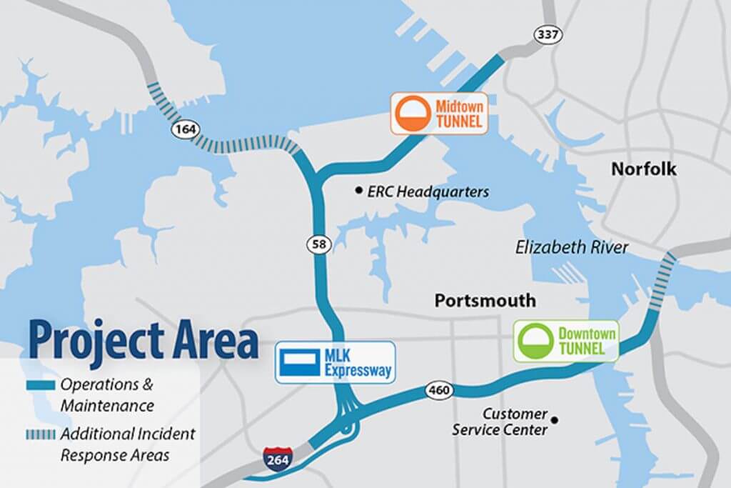
What are the project’s major benefits?
The Elizabeth River Tunnels
Project will offer broad and lasting benefits to the Hampton Roads
transportation system, its economy and the lives of those who live and work in
the region every day. Here are just a few of the benefits offered by the
Project:
=> When the Project opens, the average round trip user will save about 30
minutes a day, saving fuel and reducing gas emissions.
=> Roadway safety will improve with the elimination of bi-directional traffic
in the existing Midtown Tunnel.
=> Through increased funding as part of the project agreement, Hampton Roads
Transit will improve route frequency between Norfolk and Portsmouth. This
enhancement could spur public transportation use, offering a low cost
alternative to driving alone.
=> The Project offers regional economic development benefits estimated at $170
to $254 million.
=> More than $1 billion of construction works will be built by local
companies. More than 500 direct jobs and more than 1,000 indirect jobs will be
created through local suppliers and vendors.
=> Increased travel options will provide greater accessibility to jobs,
educational facilities, medical services, shopping and recreational
activities.
=> The improvements will provide a critical link to the various port
facilities in the region, supporting the movement of goods in and out of these
facilities.
Partnership between VDOT, ERC and SKW
VDOT has a Comprehensive Agreement with ERC, which covers all aspects of the
Project (Design, Build, Finance, Operate, and Maintenance). ERC will perform
tolling, operations, and maintenance activities. The partnership of Skanska/Kiewit/Weeks
Marine (SKW Constructors) holds the design-build contract with ERC for site
work, bridge work, marine/tunnel work and services for rehabilitation of the
existing tunnels, construction of the new Midtown Tunnel, and construction of
the MLK Extension.
ERT Project
General Project Brochure, as of
February 2017, 656 kilobytes size PDF file.

Plan view of Midtown Tunnel complex, courtesy of Talk Scheme.
ERT Project
Cost and Funding, as of
February 2017, 785 kilobytes size PDF file.
Funding for the Elizabeth
River Tunnels Project is made possible through a public-private partnership.
This is a performance-based, contractual relationship that enables private
companies to provide funding for public projects. The fixed-price,
date-certain cost for designing and building the new Midtown Tunnel and Martin
Luther King (MLK) Extension was competitively reached and third-party
validated as best value. Design and construction of the new Midtown Tunnel and
the MLK Extension, along with rehabilitation of the existing Midtown Tunnel
and the Downtown Tunnel is expected to cost $2.1 billion, including operating
costs, interest, insurance and reserves. Maintenance of the Downtown and
Midtown tunnels, and MLK Extension is expected to cost an additional $5.0
billion over the life of the contract. Funding is expected from tolls, private
equity, contributions from the Commonwealth of Virginia and a low-interest
Federal Highway Administration loan.
Project Value: $2.1 Billion
Cost and Funding
$150 million in project revenue during construction
$441.4 million in a Federal Highway Administration TIFIA loan (including
accrued interest)
$637.5 million in Private Activity Bonds -
$391 million in contributions from the Commonwealth of Virginia to reduce
tolls on the Elizabeth River Tunnels
$112.5 million in contributions from the Commonwealth of Virginia to defer
tolls on the Elizabeth River Tunnels
$251 million in equity commitments from Skanska & Macquarie (50/50)
$78 million in contributions from the Commonwealth of Virginia to eliminate
tolls on the Martin Luther King Extension
[End of excerpts from the
Elizabeth River Crossings (ERC) project website
in April 2017]
Re-tolling of the Downtown and Midtown tunnels occurred in 2014 as part of the
financing agreement for this project, and the Federal Highway Administration (FHWA)
gave VDOT the authorization to toll the Downtown Tunnel segment of Interstate
I-264.
All-Electronic Tolling (AET) is utilized, there are no toll booths, overhead
gantries have readers for vehicles equipped with E-ZPass tags, and for license plate scanning. The
E-ZPass tolls for passenger cars is $1.65 off-peak and $1.95 peak period, and
this applies to each tunnel.
ERT
Toll Rates Information
 |
Parallel Midtown Tunnel immersed tube segment placement process, courtesy
of Elizabeth River Tunnels.
This is the same conceptual
process utilized for all the immersed tube tunnels in the Hampton Roads
area, on I-64, I-264, I-664 and the Chesapeake Bay Bridge-Tunnel.
Click photo for large image. |
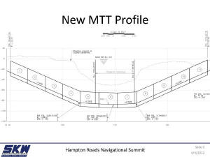 |
Parallel Midtown Tunnel profile view, courtesy of SKW Constructors.
Click photo for large image. |
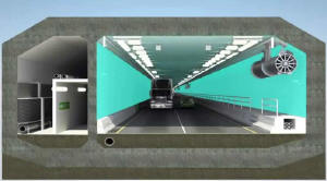 |
Parallel Midtown Tunnel cross-section view, courtesy of SKW Constructors.
Notice the emergency passage tube to the left of the traffic tube.
Notice the jet fan ventilation unit, they are also known as axial flow
ventilation and longitudinal flow ventilation; the units are stationed
throughout the tunnel.
Click photo for large image. |
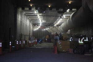 |
Parallel Midtown Tunnel under construction, February 2015, photo by
Virginia Department of Transportation. Click photo for large image. |
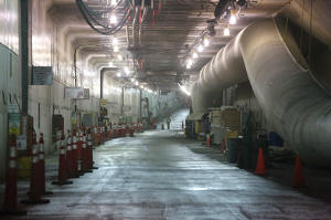 |
Parallel Midtown Tunnel under construction,
July 2015, photo by Virginia Department of Transportation.
Click photo for large image. |
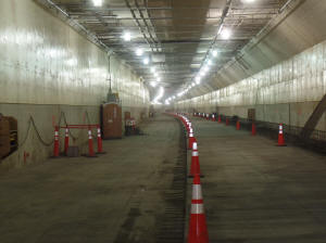 |
Parallel Midtown Tunnel under construction,
December 2015, photo by Virginia Department of Transportation.
Click photo for large image. |
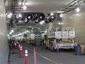 |
Parallel Midtown Tunnel under construction,
April 2016, photo by Virginia Department of Transportation.
Notice the jet fan ventilation units.
Click photo for large image. |
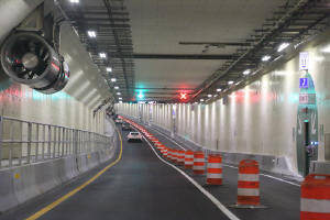 |
Parallel Midtown Tunnel opened with one lane,
June 2016, photo by Virginia Department of Transportation.
Notice the jet fan ventilation unit.
Click photo for large image. |
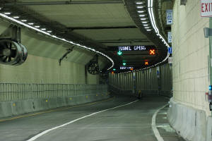 |
Parallel Midtown Tunnel opened with both
lanes, July 2016, photo by Virginia Department of Transportation.
Click photo for large image. |
Interstate Highway Designation Proposal
This proposal by
Roads to the Future
will be communicated to VDOT in June 2016.
1) Interstate Route I-164 -- Between I-664 and West Brambleton Avenue --
Western Freeway, 2-lane ramps through Pinners Point Interchange, Midtown
Tunnel approach highway in Portsmouth, Midtown Tunnel, Midtown Tunnel approach
highway in Norfolk
2) Interstate Route I-764 -- MLK Freeway between I-264 and I-164 at Pinners
Point Interchange
3) VA-164 is de-designated
4) US-58 remains as currently posted on Midtown Tunnel and approach highways,
and will overlap segments of I-764 and I-164.
The VA-164 Western Freeway connects I-664 near Churchland to the Pinners Point
Interchange in the Port Norfolk section of Portsmouth. It was completed in
sections from 1992 to 2005.
The Pinners Point Interchange was completed in
2005 along with modern freeway approaches to just south of the Midtown Tunnel,
and provides three-way high-capacity freeway-to-freeway connections to the
Midtown Tunnel, Western Freeway and MLK Freeway.
The Martin Luther King Freeway extension was
completed to I-264 near downtown Portsmouth in 2016, and the VA-164
designation was extended from the Pinners Point Interchange to I-264.
The Parallel Midtown Tunnel was completed in 2016 and renovation is underway
on the original tube that opened in 1962. This highway segment is designated
as US-58.
The aforementioned highways are built to urban Interstate standards. They
function in the roles of 3-digit Interstate highways that supplement and
augment the national Interstate highway system, serving commuter traffic and
commercial traffic and military traffic.
Proposed numbering --
The number 164 fits in the numbering scheme for Interstate highways, it is now
a primary route designation.
Roads to the Future proposes utilizing Interstate I-164 on the Western Freeway and then thru the
2-lane ramps of the Pinners Point Interchange that connect to the Midtown
Tunnel approach highway, thru the Midtown Tunnel, and with I-164 terminating at the
interchange with West Brambleton Avenue and Hampton Boulevard in downtown
Norfolk.
I-164 would be an Interstate spur route connecting I-664 to downtown Norfolk
and Hampton Boulevard. I-664 and I-164 would comprise an appropriately
designated Interstate highway connector between Hampton, Newport News,
Portsmouth and Norfolk. It could even function as an "interim third Hampton Roads
crossing".
The Martin Luther King Freeway between the Pinners Point Interchange and I-264
near downtown Portsmouth, would be designated as Interstate I-764. This is a short but
vital highway that would connect I-164 and the Midtown Tunnel to I-264 and the Downtown Tunnel / Berkley
Bridge complex.
VA-164 would be de-designated. For US-58 continuity it would remain on a
segment of I-764 and a segment of I-164, this is needed as US-58 passes from
near Cumberland Gap to the Virginia Beach oceanfront.
Regarding 3-digit Interstate spur routes branching from other 3-digit Interstate
highways, this is a valid practice. A few examples are I-370 from I-270 in
Maryland, I-795 from I-695 in Maryland, and I-195 from I-295 in New Jersey.
Sources
1) Virginia Department of Transportation (VDOT) historical information.
2) Western Freeway Extension, City of Portsmouth, Location Public Hearing
brochure from the Location Public Hearing on September 26, 1979, by VDOT.
3) Route 164 Western Freeway, City of Portsmouth, Location and Design Public
Hearing brochure, July 1984, by VDOT.
4) Route 58, Midtown Tunnel and Interchanges, Location Public Hearing brochure,
February 27 & 28, 1990, by VDOT. This includes the parallel Midtown Tunnel, the
Pinners Point Interchange, and the Western Freeway Extension (Port Norfolk Connector).
5) Environmental Assessment, Route 58 - Martin Luther King Freeway Extension,
by Virginia Department of Transportation for FHWA, completed by VDOT in May 1990.
6) Opening dates from Interstate System Opened to Traffic as of July 1,
1992, by Virginia Department of Transportation.
7) Final Environmental Impact Statement with Section 4(f) Analysis (EIS Number
FHWA-VA-EIS-89-03-F), Route 58 / Midtown Tunnel (Including Pinners Point Interchange),
approved by FHWA in November 1996. This includes the parallel Midtown Tunnel,
the Pinners Point Interchange, and the Western Freeway Extension (Port Norfolk
Connector).
8) Revised 1998-99 VDOT/CTB Six-Year Improvement Program, by VDOT
and Commonwealth Transportation Board.
9) "Portsmouth's Toll Stance Causes Alarm In Norfolk", Virginian-Pilot
newspaper article, published March 25, 1999.
10) Final Environmental Assessment, Martin Luther King Jr. Freeway Extension
Study, City of Portsmouth, prepared by Virginia Department of Transportation
for Federal Highway Administration, completed by VDOT in March 1999.
11) "Split Council In Norfolk Approaches Toll Vote", Virginian-Pilot
newspaper article, published April 7, 1999.
12) Traffic volumes from Average Daily Traffic Volumes with Vehicle Classification
Data on Interstate, Arterial and Primary Routes, by Virginia Department
of Transportation, 1997 and 2001.
13)
"Construction Will Begin on Long-Awaited Pinners Point Interchange", VDOT news
release, November 15, 2001.
14) "Pinners Point Interchange a go at Midtown Tunnel", Virginian-Pilot
newspaper article, November 16, 2001.
15)
"Contract is Signed On Pinner's Point Interchange in Portsmouth", VDOT news
release, March 7, 2002.
16)
"Pinners Point Road Project Offers Big Payoffs for Many", by
The Virginian-Pilot, January 30,
2004.
17) FY2004-2005 VDOT/CTB Six-Year Improvement Program, by VDOT and
Commonwealth Transportation Board.
18) "VDOT Opens Much-Anticipated New Portion Of Western Freeway At Pinners Point",
VDOT news release, April 27, 2004.
19) "VDOT Continues Addressing Traffic Concerns Near Pinners Point -
Traffic to Return to Old Portion of West Norfolk Bridge", VDOT news release,
May 5, 2004.
20)
"VDOT To Open Much Anticipated Portion of Western Freeway at Pinners Point this
Weekend", VDOT news release, September 17, 2004.
21) "New
Pinners Point Segment Opens to Traffic This Friday", VDOT news release,
November 17, 2004.
22) The
VDOT website
23) Limits and areas served from any good map of the state.
24)
"Governor
McDonnell Announces Contract to Build a Second Midtown Tunnel in Hampton Roads",
VDOT news release,
December 5, 2011.
25)
New U.S. 58 West Midtown Tunnel Opens One Lane Today, ERC News Release,
June 17, 2016.
26)
Two Lanes Open at U.S. 58 East Midtown Tunnel During Morning Rush Hour,
ERC news release, October 3, 2016.
27)
Martin Luther King (MLK) Expressway Opens Tomorrow, Wednesday, Nov. 30,
ERC news release,
November 29, 2016.
Copyright © 1999-2017 by Scott Kozel.
All rights reserved. Reproduction, reuse, or distribution without permission is
prohibited.
Back to top
By Scott M. Kozel, Roads to the Future
(Created 7-1999, updated 2-17-2007,
new additions added on 6-8-2017
